A Late Evening Look At Tuesday’s Potential For Strong/Severe Storms In Central Alabama
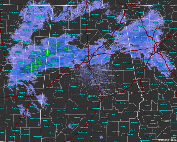
Radar check at 8:45 pm shows showers over a good chunk of the northern half of Central Alabama, especially along and north of the I-20 corridor. The southern half of the area remains mainly dry this evening. Most of the shower activity that will move in tonight and through the overnight hours look to stay mainly over the northern 2/3rds of the area which will be north of the US-80 and I-85 corridors.
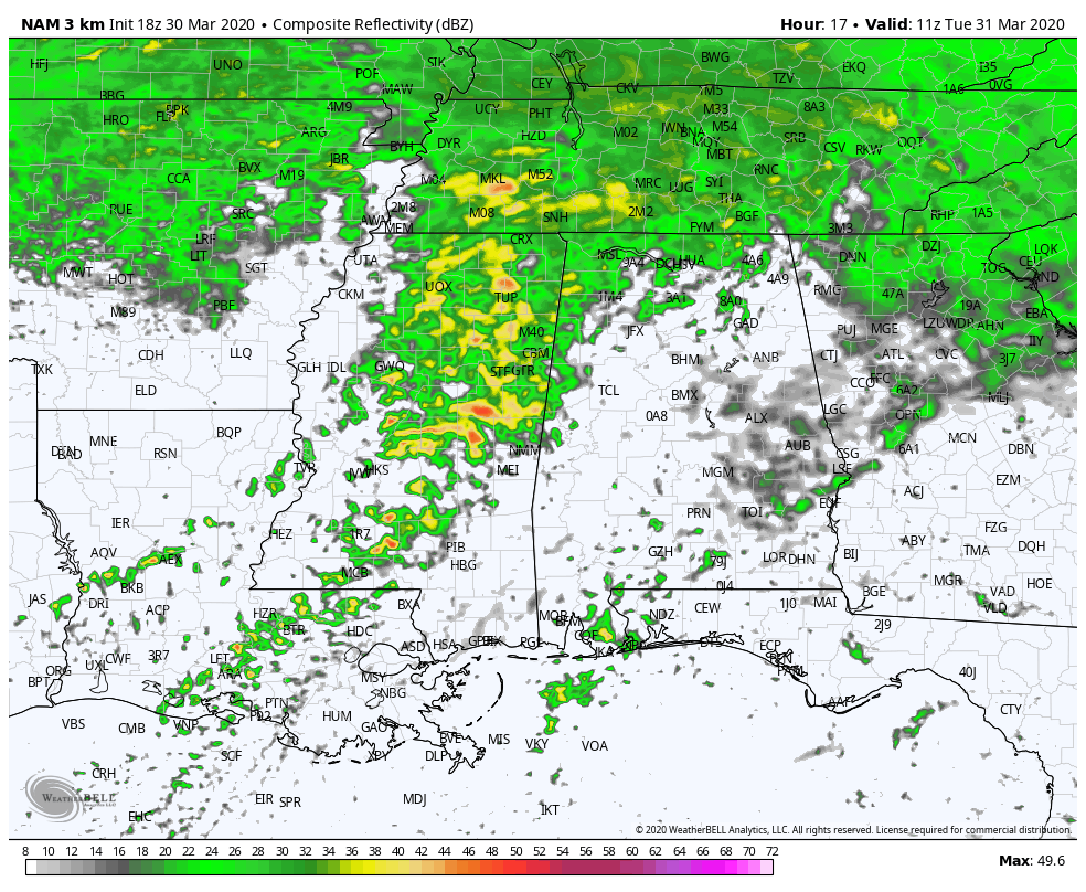
While we will have showers moving through the area during the overnight and pre-dawn hours on Tuesday morning, it doesn’t look like the main line of storms along with the surface low doesn’t move into the area until around or just after 6:00 am. Storms will progress across the area throughout the rest of the morning hours and through the early and mid-afternoon hours, before moving out and into Georgia by 3:00 pm to 4:00 pm time frame.
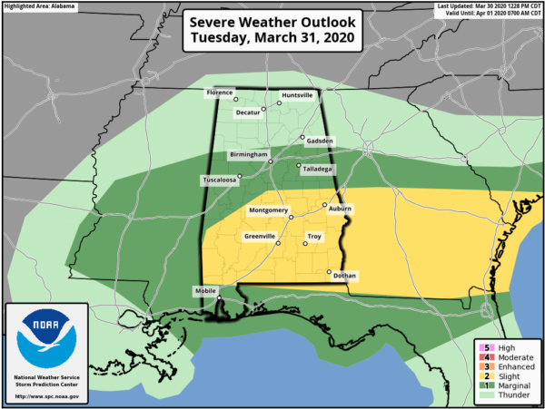
The latest Severe Weather Outlook for Tuesday continues to have a Slight Risk for severe storms for locations along and south of a line from Linden (Marengo Co.) to Lawley (Bibb Co.) to Cusetta (Chambers Co.). A Marginal Risk continues for locations along and south of a line from Detroit (Lamar Co.) to Locust Fork (Blount Co.) to Piedmont (Calhoun Co.).
All modes of severe weather will be possible in the Slight Risk locations (tornadoes, damaging winds up to 60 MPH, quarter-size hail). Threats in the Marginal Risk will be less likely but cannot be ruled out.
Timing on the potential for stronger to severe storms will start around 8:00 am in the western parts of the risk areas and should come to an end around 3:00 pm in the eastern parts as the storms exit the state and move into Georgia. While there is a threat for severe storms in the risk locations west of I-65, storms will probably end up a little more active along and east of I-65 as we’ll be reaching the peak heating of the day in those locations.
We’ll have updates throughout the day on Tuesday, especially if any watches and warnings are issued. We are in our main severe weather season for Alabama, so stay weather aware and be prepared.
Category: Alabama's Weather, ALL POSTS, Severe Weather
About the Author (Author Profile)
Scott Martin is an operational meteorologist, professional graphic artist, musician, husband, and father. Not only is Scott a member of the National Weather Association, but he is also the Central Alabama Chapter of the NWA president. Scott is also the co-founder of Racecast Weather, which provides forecasts for many racing series across the USA. He also supplies forecasts for the BassMaster Elite Series events including the BassMaster Classic.Subscribe
If you enjoyed this article, subscribe to receive more just like it.


