A Quick Check On Our Weather Situation Just After 7:00 AM
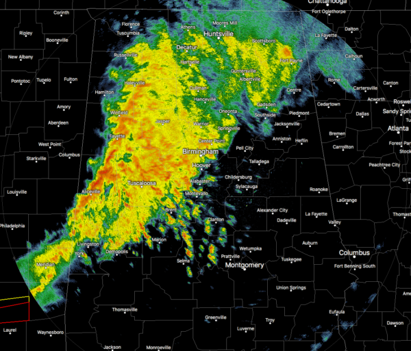
As of 6:57 am, we have a line of moderate to heavy rainfall pushing across the western parts of North/Central Alabama with lighter showers over the north and northeastern parts of the area. So far, all of this activity has stayed well-behaved, but we are approaching that time when we need to start watching for the potential of stronger to severe storms to start ramping up over the southern half of the area.
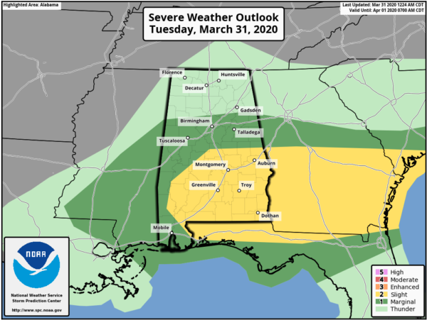
The Storm Prediction Center continues a Slight Risk for severe storms for locations along and south of a line from Linden (Marengo Co.) to Lawley (Bibb Co.) to Cusetta (Chambers Co.). A Marginal Risk continues for locations along and south of a line from Detroit (Lamar Co.) to Locust Fork (Blount Co.) to Piedmont (Calhoun Co.).
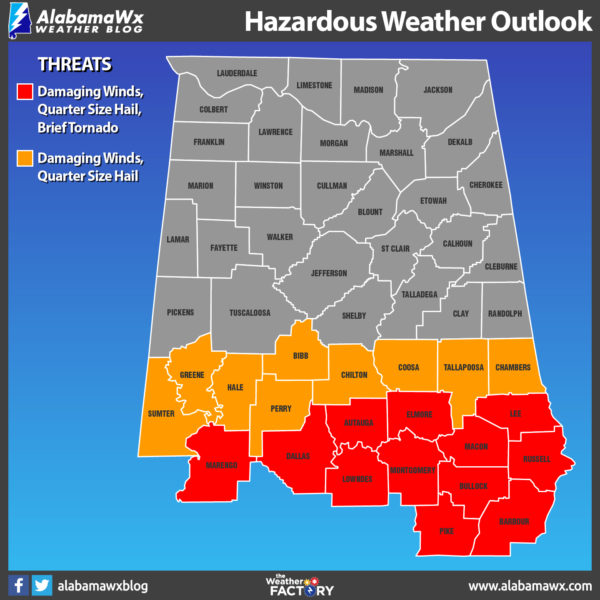
All modes of severe weather will be possible in the Slight Risk locations (tornadoes, damaging winds up to 60 MPH, quarter-size hail). Threats in the Marginal Risk will be less likely but cannot be ruled out.
Timing on the potential for stronger to severe storms will start around 8:00 am in the western parts of the risk areas and should come to an end around 3:00 pm in the eastern parts as the storms exit the state and move into Georgia. While there is a threat for severe storms in the risk locations west of I-65, storms will probably end up a little more active along and east of I-65 as we’ll be reaching the peak heating of the day in those locations.
Category: Alabama's Weather, ALL POSTS, Severe Weather
About the Author (Author Profile)
Scott Martin is an operational meteorologist, professional graphic artist, musician, husband, and father. Not only is Scott a member of the National Weather Association, but he is also the Central Alabama Chapter of the NWA president. Scott is also the co-founder of Racecast Weather, which provides forecasts for many racing series across the USA. He also supplies forecasts for the BassMaster Elite Series events including the BassMaster Classic.Subscribe
If you enjoyed this article, subscribe to receive more just like it.


