Storms Moving Out Of The Southeastern Parts Of The Area, Quiet For The Rest At Midday
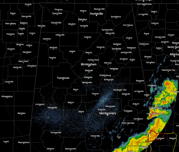
As of 12:00 pm, only the extreme southeastern parts of Central Alabama continues to experience rain and thunderstorms as the rest of the area is now rain free.
Unfortunately, we have had at least two confirmed tornadoes touch down, with the latest one causing damage to the country club at the Alabama Golf Course just south of Eufaula.
The second tornado occurred earlier very close to the Troy Municipal Airport causing some structural damage and uprooted some trees.
While a few counties remain in the Tornado Watch until 3:00 pm in our area, I’m sure NWS Birmingham will cancel the watch for those counties as the severe threat has now moved out of the area and into Georgia.
Temperatures as of 12:08 pm were in the lower 50s to the lower 70s across the area. Haleyville was the cool spot at 52 degrees while Montgomery was the warm spot at 72 degrees. Birmingham was at 61 degrees.
Clouds will be decreasing throughout the remainder of the daylight hours and so will those temperatures. We’ll fall into the lower 50s to the upper 60s by 4:00 pm and down into the upper 40s to the mid-50s by 10:00 pm. We’re looking at lows dipping down into the upper 30s to the mid-40s.
Category: Alabama's Weather, ALL POSTS, Severe Weather
About the Author (Author Profile)
Scott Martin is an operational meteorologist, professional graphic artist, musician, husband, and father. Not only is Scott a member of the National Weather Association, but he is also the Central Alabama Chapter of the NWA president. Scott is also the co-founder of Racecast Weather, which provides forecasts for many racing series across the USA. He also supplies forecasts for the BassMaster Elite Series events including the BassMaster Classic.Subscribe
If you enjoyed this article, subscribe to receive more just like it.


