Storm Moving Into Pickens County Will Have Hail
Storms along the warm front are becoming stronger in spots late this morning as warm, moist air surges northward on the back of 50-60 knot low-level jet up at about 5,000 feet in the atmosphere. The dewpoint at Meridian has jumped from 58 to 65 over the past three hours.
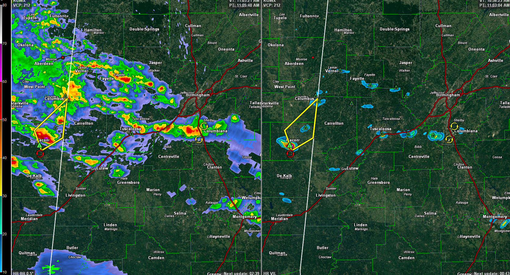
The storm near Macon MS shows all and there are ground truth reports of dime-sized hail. It has a severe thunderstorm warning on it. The NWS in Birmingham is monitoring it in case a warning is required for Pickens County.
The storm near Tuscaloosa shows hail and there are reports of pea-sized hail from it.
A cluster of stronger storms is moving into southern parts of the Birmingham metro. They are not severe but could have pea-sized hail.
The graphic shows reflectivity on the left, depicting where rainfall is falling. The right side shows VIL, or vertically integrated liquid, which is a good indicator of hail
Category: Alabama's Weather, ALL POSTS, Severe Weather
About the Author (Author Profile)
Bill Murray is the President of The Weather Factory. He is the site's official weather historian and a weekend forecaster. He also anchors the site's severe weather coverage. Bill Murray is the proud holder of National Weather Association Digital Seal #0001 @wxhistorianSubscribe
If you enjoyed this article, subscribe to receive more just like it.


