Key Points From NWS Birmingham’s Latest Mesoscale Discussion
Some key points from the NWS Birmingham’s Mesoscale Discussion written by Jason Holmes:
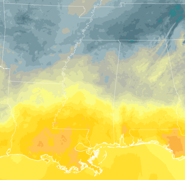
Latest surface temperatues.
The surface warm front continues to lift northward, right now in north-central Louisiana and into southern Mississippi, and southwest Alabama. That warm front will continue to lift northward, with elevated storms continuing out ahead of it across the northern half of the area.
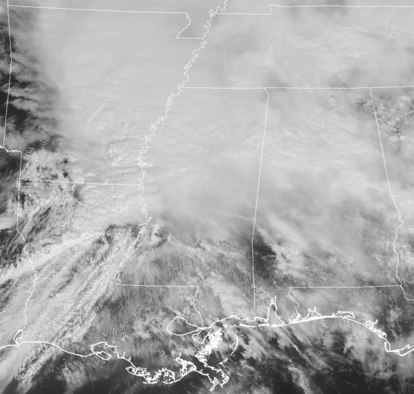
Dew points are increasing, and the sun is now coming out over southern Mississippi at this hour looking at the visible satellite. Dynamics are becoming favorable for severe storm development across central and southern Mississippi where the current PDS watch is in effect.
Also just posted on NWS Chat by Gary Goggins of NWS Birmingham:
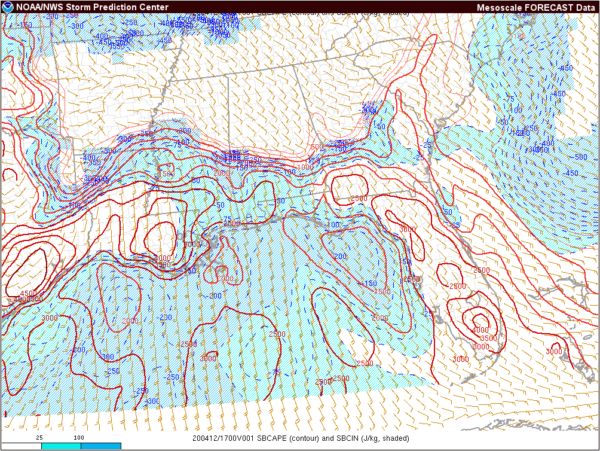
Surface destabilization is occurring areawide, with the highest increase of course south of the warm front. The risk for damaging winds and tornadoes will increase with further destabilization as we go into the afternoon hours. We may actually have a break in the action this afternoon with a bit more drier air moving in aloft that would act as a “cap” to limit development. However, that “cap” is expected to break with the approach of the overall system.
Category: Alabama's Weather, ALL POSTS, Severe Weather
About the Author (Author Profile)
Scott Martin is an operational meteorologist, professional graphic artist, musician, husband, and father. Not only is Scott a member of the National Weather Association, but he is also the Central Alabama Chapter of the NWA president. Scott is also the co-founder of Racecast Weather, which provides forecasts for many racing series across the USA. He also supplies forecasts for the BassMaster Elite Series events including the BassMaster Classic.Subscribe
If you enjoyed this article, subscribe to receive more just like it.


