Very Nice At Midday; Severe Storm Potential On Sunday Night
CONDITIONS ACROSS CENTRAL ALABAMA AT 11:20 AM
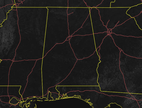
As of 11:20 am, we have sunny skies across all of Central Alabama with not a cloud insight on the latest visible satellite image. If there are any out there, they are just simply too small to be seen at this point. Temperatures as of the 11:00 am roundup were in the 60s across the area. Birmingham was at 63 degrees. The cold spots were Gadsden and Haleyville at 60 degrees. The warm spot was Troy at 68 degrees.
We’ll have sunny skies throughout the remainder of the daylight hours with afternoon highs topping out in the upper 60s to the mid-70s across the area from north to south. For tonight, skies will remain clear and lows will drop down into the mid-40s to the lower 50s.
SEVERE STORM POTENTIAL ON SUNDAY NIGHT
A strong system will be moving through the southeast on Sunday that will have the potential for severe storms to impact Central Alabama. All modes of severe weather will be possible: tornadoes, damaging winds up to 60-70 MPH, and hail up to the size of a quarter. At this point, the timing looks to be from roughly 6:00 pm Sunday evening through roughly 2:00 am Monday morning.
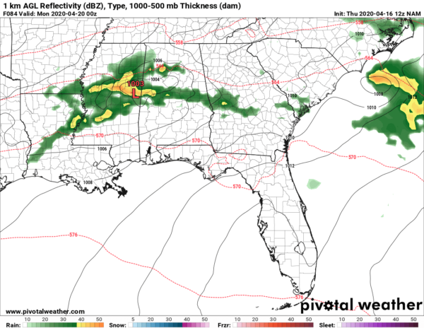
The latest run of the lower resolution NAM shows a strong surface low beginning to move into the western parts of the area around 7:00 pm. It will be moving in a northeasterly direction, pulling a warm front up to the north out ahead of it. Much of the area will be in the warm, unstable sector at this time which may allow for the formation of a few supercells that are capable of producing tornadoes, damaging winds, and hail. The low will be bringing a cold front through the area and a squall line is expected to be along or just ahead of the front. The main threat will shift to damaging winds, but a few embedded tornadoes will remain possible, along with hail.
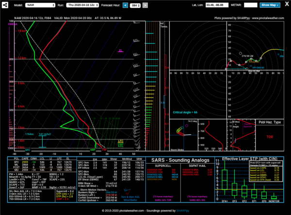
The sounding from the same model run at the same time shows a forecast CAPE value (instability) well over 3000 J/kg. Helicity values are on the lower side, around 174 m2/s2 which is enough for rotating updrafts, but the expectation is that helicity will be on the increase until the front arrives and passes. There will be sufficient wind shear as well, so the ingredients are there to support the threats mentioned above.
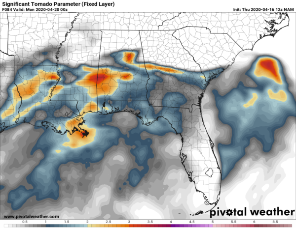
At this point, the Significant Tornado Parameter values are in the 1.0-3.6 range across the central and southern portions of the area with the above image valid at 7:00 pm on Sunday night. The good news is that this system does not appear to be as strong as the Easter Sunday event, but do not sleep on this one as the potential is there for tornadoes, damaging winds, and hail.
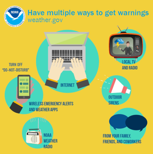
You know the drill… Have your emergency supplies, your safety plan, and your place of safety ready to go. Be sure you have multiple ways of receiving warnings and do not rely just on the sound of an outdoor siren. You cannot ride out a tornado in a mobile/manufactured home. Have a plan to get to a more sturdy structure or to a storm shelter.
Category: Alabama's Weather, ALL POSTS, Severe Weather
About the Author (Author Profile)
Scott Martin is an operational meteorologist, professional graphic artist, musician, husband, and father. Not only is Scott a member of the National Weather Association, but he is also the Central Alabama Chapter of the NWA president. Scott is also the co-founder of Racecast Weather, which provides forecasts for many racing series across the USA. He also supplies forecasts for the BassMaster Elite Series events including the BassMaster Classic.Subscribe
If you enjoyed this article, subscribe to receive more just like it.


