

Flash Flood Watch Starts This Evening; Two Potential Waves of Severe Weather: Late Tonight, Thursday Afternoon/Evening
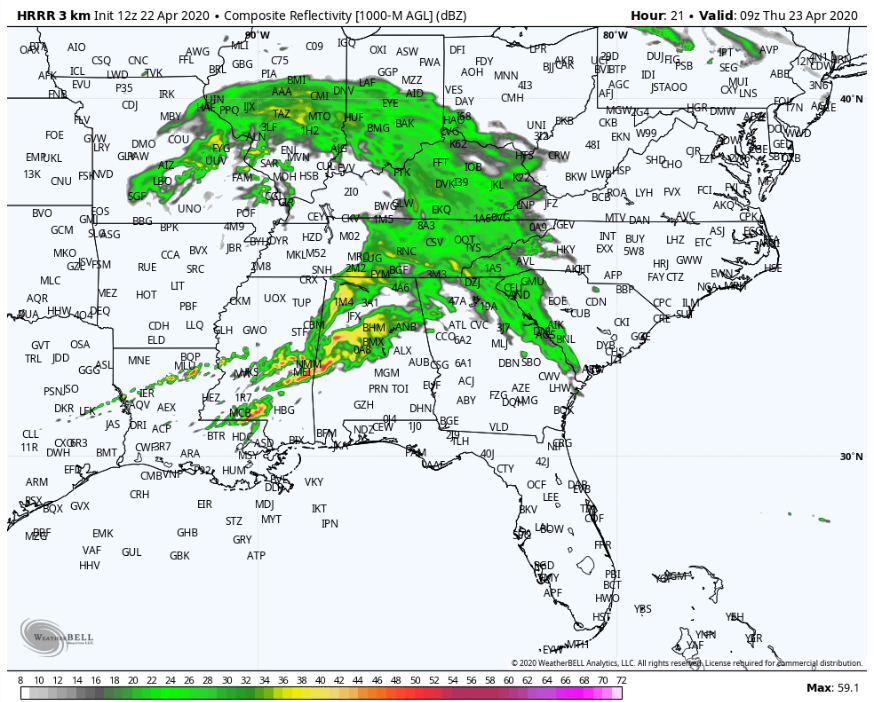
Simulated radar from the high resolution NAM for 4 am Thursday morning showing strong storms over West Central Alabama.
A line of thunderstorms will develop over Arkansas late this evening. That line will cross the Mississippi River around 3 a.m. and reach western Alabama around 5-6 a.m. Some showers and storms will reach western sections of the state a little earlier. These advance storms will be elevated in nature and could produce damaging winds and hail. The main line will be weakening as it pushes deeper into Alabama, reaching I-59 around 8-9 a.m. It could produce winds of 65 mph, primarily for areas northwest of I-59 early in the morning.
As this line pushes southeast, it could prevent the development of strong afternoon storms in the areas it passes. But to the south of its progress, storms could develop along or south of the I-20/59 corridor after 2 pm, moving southeast and exiting the southeast portions of the state by midnight.
It is a conditional threat, meaning the threat is dependent on the state of the atmosphere. It is quite possible that severe weather will be very isolated or not occur at all Thursday afternoon/night if the atmosphere is unable to become unstable after the first wave of storms. But, if the atmosphere recovers or is untouched further south, a more widespread threat will develop. It could take the form of a broken to solid line of storms. All modes of severe weather are possible with these storms, including large hail, damaging winds, and tornadoes.
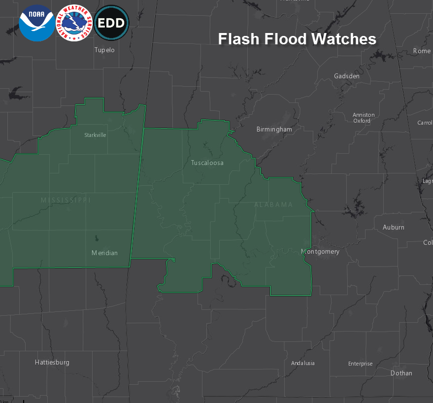
Widespread 1-3 inches rainfall amounts are expected, with some locations receiving more. The highest rainfall amounts will be between I-20/US-82 and US-84, including places like Tuscaloosa, Centreville, Clanton, Demopolis, and Selma.
This is where the highest rainfall totals occurred on Sunday, and flash flooding is possible in this region. A flash flood watch will go into effect at 10 p.m. CDT tonight for these areas:
We are watching another system Friday night into Saturday morning that should produce little to no severe weather, but as we say in Alabama in the spring: “When it comes to thunderstorms, expect the unexpected.”
Review your severe weather safety plan and be weather aware overnight and tomorrow.
Category: Alabama's Weather, ALL POSTS
About the Author (Author Profile)
Bill Murray is the President of The Weather Factory. He is the site's official weather historian and a weekend forecaster. He also anchors the site's severe weather coverage. Bill Murray is the proud holder of National Weather Association Digital Seal #0001 @wxhistorianSubscribe
If you enjoyed this article, subscribe to receive more just like it.


