An Evening Look at the Alabama Weather Situation at 8 p.m.
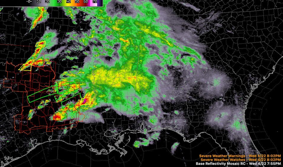
Rain and storms over Louisiana, Arkansas, and Mississippi are pushing east northeast tonight ahead of a trough that is moving out of Texas and Oklahoma.
A stationary front is draped across Central Louisiana, along the Louisiana/Mississippi border, and into coastal Mississippi. This front will come northward as a warm front overnight as the trough pushes east.
A weak surface low near Sherman, Texas will move northeast and slowly intensify as it moves toward the Ohio Valley by tomorrow afternoon. That front will push through Alabama and be near the Tennessee border by noon tomorrow.
A mesoscale convective system will form over Louisiana tonight and this complex of storms will advance east-northeastward across Mississippi and into western Alabama after midnight. Our best estimate for timing is around 1-3 a.m. in the west. They will likely reach the I-59 Corridor including Tuscaloosa – Birmingham – Gadsden between 4-6 a.m.
An increasing ow level jet and increasing mid-level winds will help these storms remain strong despite the fact that they are elevated in nature. They will still be capable of producing damaging winds as they push into western Alabama. Just remember the damage the storm was able to produce across Chilton, Coosa, and Tallapoosa Counties early Sunday morning with dewpoints in the 40s. There could be some hail as well.
The big question is how much redevelopment can occur during the afternoon. If the airmass can recover, an even more significant round of severe weather is possible across parts of Alabama. Large hail looks to be the biggest threat, but tornadoes can’t be ruled out in areas where substantial instability develops.
We will have frequent updates throughout the night and tomorrow.
Category: Alabama's Weather, ALL POSTS, Severe Weather
About the Author (Author Profile)
Bill Murray is the President of The Weather Factory. He is the site's official weather historian and a weekend forecaster. He also anchors the site's severe weather coverage. Bill Murray is the proud holder of National Weather Association Digital Seal #0001 @wxhistorianSubscribe
If you enjoyed this article, subscribe to receive more just like it.


