Clearing Skies at Midday, but Rain Returns After Midnight
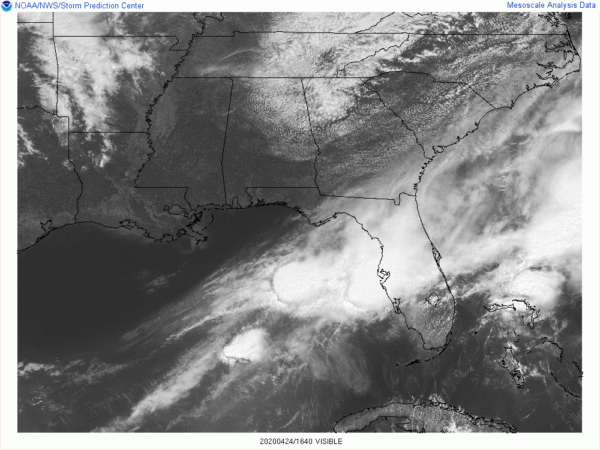
As we close in on the midday hour across Central Alabama, the northeastern quarter of the area is still dealing with clouds left over from yesterday’s system while the rest of the area is enjoying plenty of sunshine. Temperatures were in the lower 60s to the lower 70s. Cullman was the cool spot at 62 degrees while Troy was the warm spot at 73 degrees. Birmingham was coming in at an even 70 degrees.
Those clouds will clear out over the next couple of hours, but those clouds back to the west over Missouri, Arkansas, and Louisiana will eventually make it into the area later this evening as a system will move across the northern half of Central Alabama and across Tennessee and Kentucky during the overnight hours and much of the day on Saturday. Highs should top out in the mid to upper 70s across the area for today while staying dry.
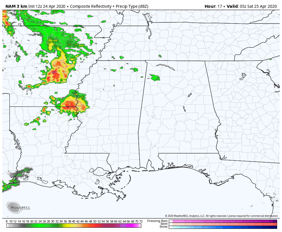
The animated radar simulation is from the latest run of the NAM-3k valid from midnight tonight through midnight Saturday night, and we see that showers will start to become possible across the northwestern parts of the area and eventually spreads eastward through the pre-dawn hours with heavier activity with thunder moving ain’t or just before sunrise. Most of the activity will then stay north of the area, but scattered activity looks to form and move across the northern half of North/Central Alabama during the rest of the day on Saturday. Highs look to range from the lower 70s to the mid-80s across the area from northwest to southeast.
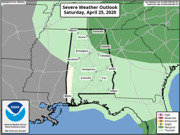
There may be a strong storm or two over the northeastern quarter of North/Central Alabama during the afternoon and into the evening hours with some hail and gusty winds being the main threat. There is just enough of a threat that the Storm Prediction Center has a LEVEL 1 MARGINAL RISK up for locations east and north of a line from Athens to Oneonta to just south of Ranburne on Saturday. The rest of North/Central Alabama has a general thunderstorm risk, but it looks like the general consensus of the activity will stay along and north of a line from Carrollton to Alabaster to Wedowee.
Category: Alabama's Weather, ALL POSTS, Severe Weather
About the Author (Author Profile)
Scott Martin is an operational meteorologist, professional graphic artist, musician, husband, and father. Not only is Scott a member of the National Weather Association, but he is also the Central Alabama Chapter of the NWA president. Scott is also the co-founder of Racecast Weather, which provides forecasts for many racing series across the USA. He also supplies forecasts for the BassMaster Elite Series events including the BassMaster Classic.Subscribe
If you enjoyed this article, subscribe to receive more just like it.


