

A Very Beautiful & Refreshing Saturday at Midday
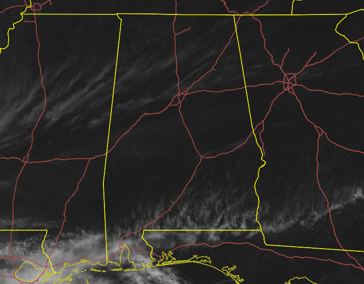
Only a few high clouds are floating overhead on this beautiful and refreshing Saturday at midday. Temperatures as of the midday round-up were in the mid-50s to the mid-60s across the area. Birmingham was at 59 degrees. The warm spot was Troy at 66 degrees. The cool spot was Haleyville at 56 degrees.
We’ll continue to have mainly sunny skies throughout the remainder of the daylight hours with afternoon highs reaching the mid-60s to the lower 70s. For tonight, skies will be clear across the northern parts of the area with a few clouds moving in across the southern parts of the area. Patchy frost is possible in the north as lows look to dip into the mid-30s to the mid-40s from north to south.
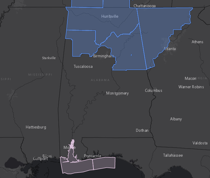
A FROST ADVISORY is up for all of North Alabama and much of the northern half of Central Alabama starting Sunday at 1:00 am and expiring at 8:00 am. Central Alabama counties in the advisory are Blount, Calhoun, Cherokee, Clay, Cleburne, Etowah, Fayette, Marion, Randolph, St. Clair, Talladega, Walker, and Winston.
MOTHER’S DAY
We may start off the day with a few clouds on Sunday, but Mother’s Day will turn out beautiful as skies will be mostly sunny by the afternoon. While still below average for this time of year, temperatures will be warmer. Highs will range from the lower 70s in the north to the upper 70s in the extreme south. Overnight lows will be in the mid to upper 40s.
MONDAY
On Monday, ridging starts to build to our west and will help the trough over the eastern US push on out to sea. It will be a beautiful day with plenty of sunshine; plus, this looks to be the last day of these cooler temperatures. Afternoon highs will be in the upper 60s to the upper 70s.
TUESDAY
A disturbance approaches Central Alabama from the west on Tuesday, but it looks like it will stay west of the area throughout the entire day. We’ll have partly to mostly sunny skies with afternoon highs reaching the lower 70s to the lower 80s.
WEDNESDAY
Once again for Wednesday, the disturbance will continue to hang out just to our west that will float some clouds over in our direction, but it looks like we’ll stay dry once again for the most part. A stray shower or two may venture over the Mississippi state line into the western parts of Central Alabama, but that doesn’t look likely at this point. Highs will range from the lower 80s in the north to the upper 80s in the extreme south.
THURSDAY
It looks like the showers will split around us on Thursday as much of the activity will go north of us while the rest moves to the south. We’ll have plenty of sunshine and afternoon highs will be in the mid to upper 80s.
FRIDAY
Friday may contain our best shot for any shower activity as moisture from a disturbance in the Gulf will move up into the southeastern parts of Central Alabama. At this point, it may only reach as far north as the I-85 corridor and chances look to only be topping out around 20%. Skies will be partly to mostly sunny and afternoon highs will be in the mid-80s to the lower 90s.
ATLANTIC HURRICANE SEASON IS LESS THAN ONE MONTH AWAY
That’s right, the 2020 Atlantic Hurricane Season starts on June 1st and will go through November 30th. According to the experts at Colorado State University, 2020 may go down as a busy year. They are forecasting 16 named storms, including eight hurricanes. For of those hurricanes will become major hurricanes reaching Category 3 strength or greater. There is a 95% chance that a hurricane will move onshore along the US Coastline and a 69% chance that a major hurricane will make landfall on the US Coastline.
Here are the names on the 2020 Atlantic Hurricane list:
Arthur, Bertha, Cristobal, Dolly, Edouard, Fay, Gonzalo, Hanna, Isaias, Josephine, Kyle, Laura, Marco, Nana, Omar, Paulette, Rene, Sally, Teddy, Vicky, and Wilfred.
If we happen to exceed the 21 names on the list, then names will be taken in order of the Greek alphabet: Alpha, Beta, Gamma, Delta, Epsilon, Zeta, Eta, Theta, Iota, Kappa, Lambda, Mu, Nu, Xi, Omicron, Pi, Rho, Sigma, Tau, Upsilon, Phi, Chi, Psi, and Omega.
A SPECIAL WEATHERBRAINS EVENT ON MONDAY NIGHT
WeatherBrains will have a treat for the fans of the show as they will have special guests who took part in the making of the “Mr. Tornado” episode of American Experience all about Dr. Ted Fujita. Michael Rossi (writer, director, and producer of “Mr. Tornado”) and the legendary Dr. Greg Forbes (of The Weather Channel) will talk about their roles in the episode. Also joining the show is WeatherBrains alum Jen Henderson who is writing a book on Dr. Ted Fujita. WeatherBrains starts at 8:00 pm CDT at live.bigbrainsmedia.com or on James Spann’s Youtube channel. PBS’ American Experience: Mr. Tornado will premiere on Tuesday evening, May 19th at 8:00 pm on your local APT channel.
ON THIS DAY IN WEATHER HISTORY
1985 – Lightning struck some trees about 150 yards away from a home in Alabama, and followed the driveway to the home. The charge went through the house and burned all the electrical outlets, ruined appliances, and blasted a hole in the concrete floor of the basement.
1988 – A massive cyclone in the central U.S. produced severe thunderstorms from eastern Texas to the Upper Ohio Valley. A strong (F-3) tornado ripped through Middleboro KY causing more than 22 million dollars damage. Thunderstorms in east-central Texas produced hail three and a half inches in diameter at Groesbeck, and near Fairfield.
BEACH FORECAST
Even though the beaches across the Alabama and Florida Gulf Coasts are closed, you may still want to know what the weather will be like. Get the latest weather and rip current forecasts for the beaches from Bay St. Louis, MS, to Panama City Beach, FL, on our Beach Forecast Center page. There, you can select the forecast of the region that you are interested in.
ADVERTISE ON THE BLOG!
We had another fantastic year in 2019 with just over 17 million page views! That brings our total for the last 2 years close to 37 million page views! Don’t miss out! We can customize a creative, flexible, and affordable package that will suit your organization’s needs. Contact Bill Murray at (205) 687-0782.
E-FORECAST
Get the Alabama Wx Weather Blog’s Seven-Day Forecast delivered directly to your inbox by email twice daily. It is the most detailed weather forecast available in Central Alabama. Subscribe here… It’s free!
CONNECT WITH THE BLOG ON SOCIAL MEDIA
You can find the AlabamaWx Weather Blog on the major social media networks:
Facebook
Twitter
Instagram
Category: Alabama's Weather, ALL POSTS
About the Author (Author Profile)
Scott Martin is an operational meteorologist, professional graphic artist, musician, husband, and father. Not only is Scott a member of the National Weather Association, but he is also the Central Alabama Chapter of the NWA president. Scott is also the co-founder of Racecast Weather, which provides forecasts for many racing series across the USA. He also supplies forecasts for the BassMaster Elite Series events including the BassMaster Classic.Subscribe
If you enjoyed this article, subscribe to receive more just like it.


