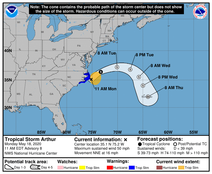
Center of Arthur Passing Just Southeast of Cape Hatteras
SUMMARY OF 1000 AM CDT…1500 UTC…INFORMATION
LOCATION…35.1N 75.2W
ABOUT 20 MI…30 KM ESE OF CAPE HATTERAS NORTH CAROLINA
MAXIMUM SUSTAINED WINDS…50 MPH…85 KM/H
PRESENT MOVEMENT…NNE OR 30 DEGREES AT 16 MPH…26 KM/H
MINIMUM CENTRAL PRESSURE…996 MB…29.42 INCHES
SUMMARY OF WATCHES AND WARNINGS IN EFFECT
A Tropical Storm Warning is in effect for…
* Surf City to Duck NC
* Pamlico and Albemarle Sounds
DISCUSSION AND OUTLOOK
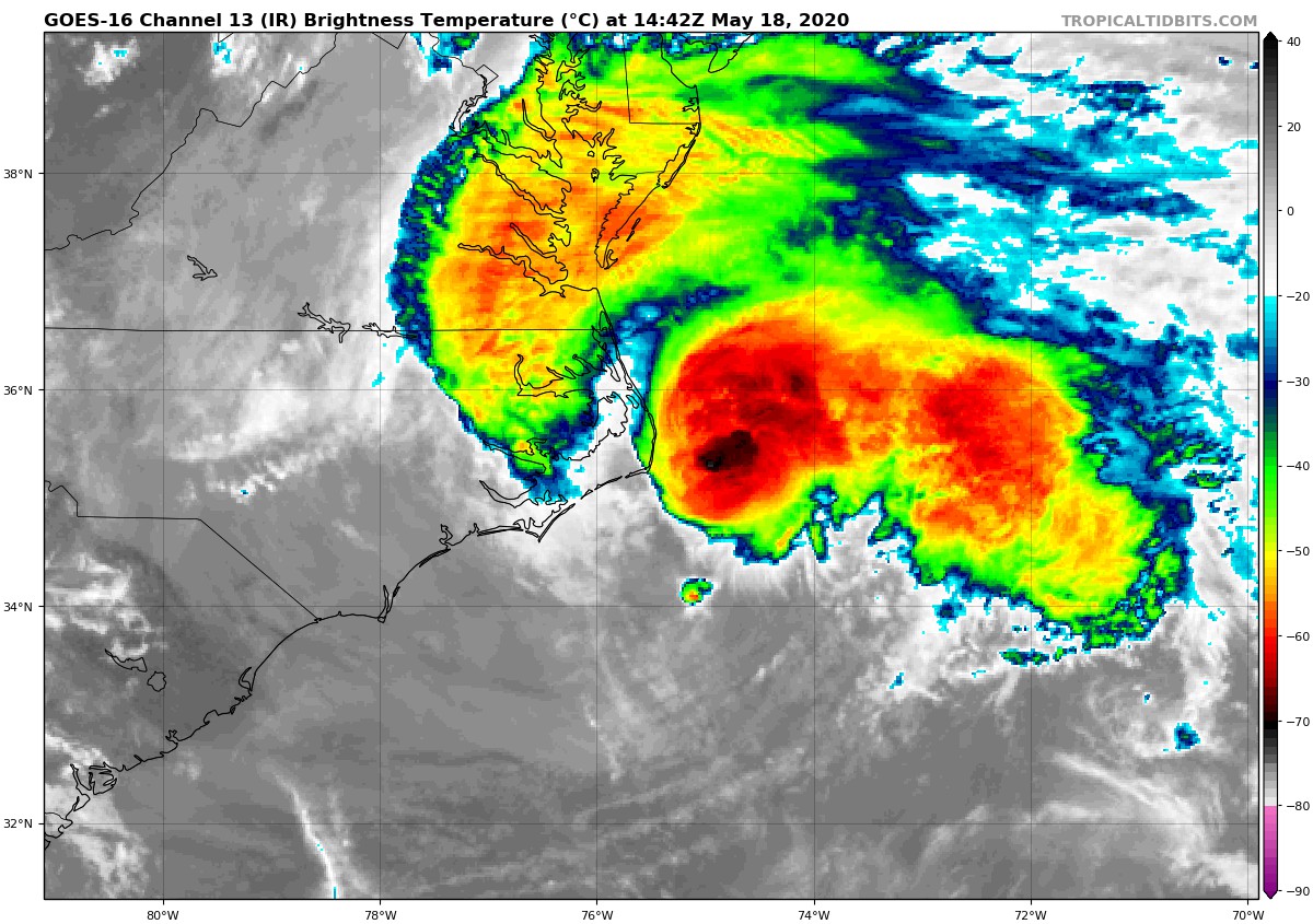
At 10:00 AM CDT (1500 UTC), the center of Tropical Storm Arthur was located near latitude 35.1 North, longitude 75.2 West. Arthur is moving toward the north-northeast near 16 mph (26 km/h). A turn toward the northeast is expected later today, followed by a turn toward the east on Tuesday. A slower southeast or south-southeast motion is forecast to begin Tuesday night and continue through Wednesday. On the forecast track, the center of Arthur will begin moving away from the North Carolina Outer Banks this afternoon. Arthur is then forecast to turn away from the east coast of the United States tonight and Tuesday.
Reports from an Air Force Reserve reconnaissance aircraft indicate that the maximum sustained winds are near 50 mph (85 km/h) with higher gusts. Some additional strengthening is forecast during the next 24 hours. Little change in strength is expected Tuesday night and Wednesday.
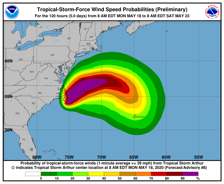
Tropical-storm-force winds extend outward up to 125 miles (205 km) from the center, primarily over water to the east of the center. NOAA buoy 41025 located about 20 miles (30 km) southeast of Cape Hatteras, North Carolina, reported sustained winds of 43 mph (68 km/h) with a gust to 49 mph (80 km/h).
The latest minimum central pressure estimated from reconnaissance aircraft data is 996 mb (29.42 inches).
HAZARDS AFFECTING LAND
WIND: Tropical storm conditions are expected within the Tropical Storm Warning area through early afternoon.
RAINFALL: Arthur is expected to produce total rain accumulations of 1 to 3 inches over coastal North Carolina through this afternoon, with isolated maximum amounts of 5 inches.
SURF: Swells generated by Arthur are affecting portions of the southeast U.S. coast and are expected to spread northward along the U.S. mid-Atlantic coast during the next day or so. These swells could cause life-threatening surf and rip current conditions.
About the Author (Author Profile)
Scott Martin is an operational meteorologist, professional graphic artist, musician, husband, and father. Not only is Scott a member of the National Weather Association, but he is also the Central Alabama Chapter of the NWA president. Scott is also the co-founder of Racecast Weather, which provides forecasts for many racing series across the USA. He also supplies forecasts for the BassMaster Elite Series events including the BassMaster Classic.Subscribe
If you enjoyed this article, subscribe to receive more just like it.


