Strong Storms Occurring Across the Southern Half of Central Alabama
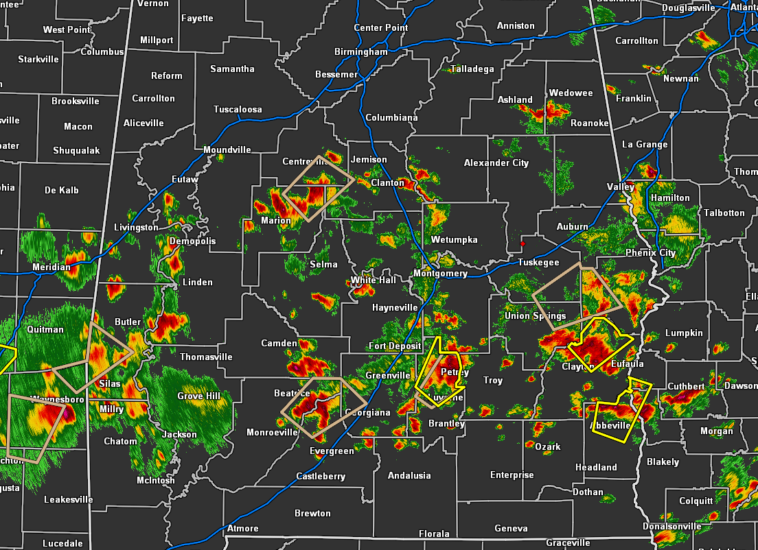
It is an active late afternoon across the southern half of Central Alabama as we have numerous storms ongoing, some of which are producing gusty winds and small hail. We currently have a grand total of 7 active significant weather advisories and 3 severe thunderstorm warnings south of the I-20 corridor all of the way down to the I-10 corridor in Alabama. All of this activity is pushing to the northeast.
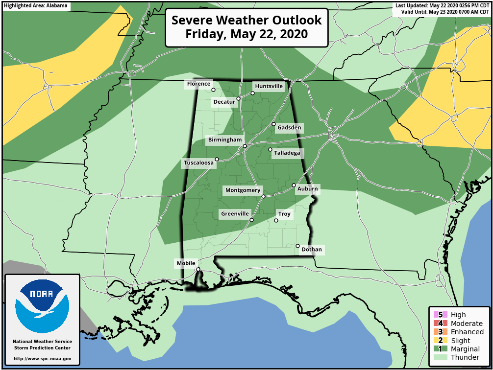
The 3:00 pm update from the Storm Prediction Center has a Level 1 Marginal Risk for severe storms for nearly all of North Central Alabama through the rest of the day. Instability is quite strong over the area and a warm front moving northward is providing the needed lift for these storms to form.
Strong thunderstorms are possible across Central Alabama through 8:00 pm. Storms will be most numerous south and east. The strongest storms will produce isolated damaging wind gusts to 60 mph and nickel size hail.
Category: Alabama's Weather, ALL POSTS, Severe Weather
About the Author (Author Profile)
Scott Martin is an operational meteorologist, professional graphic artist, musician, husband, and father. Not only is Scott a member of the National Weather Association, but he is also the Central Alabama Chapter of the NWA president. Scott is also the co-founder of Racecast Weather, which provides forecasts for many racing series across the USA. He also supplies forecasts for the BassMaster Elite Series events including the BassMaster Classic.Subscribe
If you enjoyed this article, subscribe to receive more just like it.


