A Brief Early Evening Look at Our Weather Situation
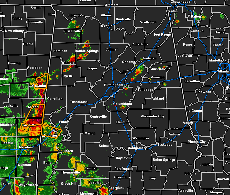
At 5:25 pm, we have some active weather across Central Alabama as we have strong storms over the northwestern and southwestern parts of the area, to go along with some smaller but strong thunderstorms over the east-central parts of the area.
These storms are producing gusty winds, heavy rainfall, dangerous cloud-to-ground lightning, and some small hail. All of this activity is moving to the northeast to north-northeast. There is plenty of instability in place that will allow for these thunderstorms to continue for a few more hours.
There is a very small possibility that a few storms may reach severe limits as large hail and damaging downdraft thunderstorm wind gusts up to 60 MPH will be possible.
We’ll keep you posted through the evening. All of the activity should start to calm down after sunset with most rain coming to an end by the end of the late local news.
Category: Alabama's Weather, ALL POSTS, Severe Weather
About the Author (Author Profile)
Scott Martin is an operational meteorologist, professional graphic artist, musician, husband, and father. Not only is Scott a member of the National Weather Association, but he is also the Central Alabama Chapter of the NWA president. Scott is also the co-founder of Racecast Weather, which provides forecasts for many racing series across the USA. He also supplies forecasts for the BassMaster Elite Series events including the BassMaster Classic.Subscribe
If you enjoyed this article, subscribe to receive more just like it.


