Bertha Weakens to a Tropical Depression
SUMMARY OF 100 PM CDT…1800 UTC…INFORMATION
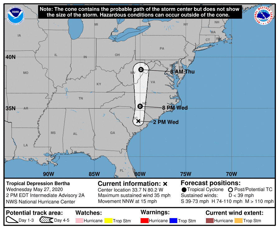
LOCATION…33.7N 80.2W
ABOUT 65 MI…105 KM NNW OF CHARLESTON SOUTH CAROLINA
MAXIMUM SUSTAINED WINDS…35 MPH…55 KM/H
PRESENT MOVEMENT…NNW OR 330 DEGREES AT 15 MPH…24 KM/H
MINIMUM CENTRAL PRESSURE…1007 MB…29.74 INCHES
WATCHES AND WARNINGS
All Tropical Storm Warnings have been discontinued.
DISCUSSION AND OUTLOOK
At 100 PM CDT (1800 UTC), the center of Tropical Depression Bertha was located near latitude 33.7 North, longitude 80.2 West. Bertha is moving toward the north-northwest near 15 mph (24 km/h). This general motion is expected to continue through tonight, followed by a turn to the north along with an increase in forward speed on Thursday. On the forecast track, Bertha will move across northern South Carolina later today and into central North Carolina by tonight.
Maximum sustained winds have decreased to near 35 mph (55 km/h) with higher gusts, mainly along the coast to the east of the center. Additional weakening is forecast during the next 48 hours, and Bertha is expected to become a remnant low tonight.
At Oyster Landing, SC a wind gust to 41 mph (66 km/h) was reported at 1245 PM EDT. The estimated minimum central pressure is 1007 mb (29.74 inches).
HAZARDS AFFECTING LAND
RAINFALL: Bertha is expected to produce total rain accumulation of 2 to 4 inches with isolated totals of 8 inches across eastern and central South Carolina into west-central to far southeastern North Carolina and southwest Virginia. Given very saturated antecedent conditions, this rainfall may produce life-threatening flash flooding, aggravate and prolong ongoing river flooding, and produce rapid out of bank rises on smaller rivers.
WIND: Gusty winds will continue over eastern South Carolina for the remainder of today.
About the Author (Author Profile)
Scott Martin is an operational meteorologist, professional graphic artist, musician, husband, and father. Not only is Scott a member of the National Weather Association, but he is also the Central Alabama Chapter of the NWA president. Scott is also the co-founder of Racecast Weather, which provides forecasts for many racing series across the USA. He also supplies forecasts for the BassMaster Elite Series events including the BassMaster Classic.Subscribe
If you enjoyed this article, subscribe to receive more just like it.


