An Early Evening Radar Check
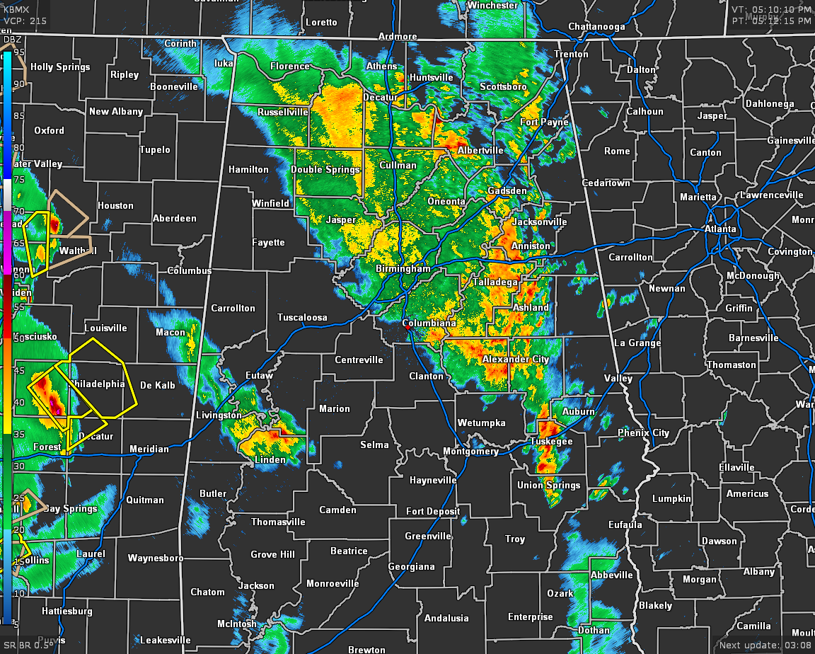
As of 5:10 pm, we continue to have a broad band of showers and thunderstorms pushing across North/Central Alabama stretching as afar as nearly all of North Alabama to thinking down to a point just south of Union Springs in Bullock County. The good news is that none of these are particularly strong, but you can expect some heavy downpours, gusty winds, and dangerous cloud-to-ground lightning especially on the leading parts of the band.
The threat for any stronger to severe storms will be along and south of a line from Demopolis to Clanton to Wedowee for the rest of the evening hours until around 8:00 pm, and that is only a LEVEL 1 MARGINAL RISK with the potential of damaging winds up to 60 MPH. After that, shower and thunderstorm activity will become more isolated to widely scattered in nature.
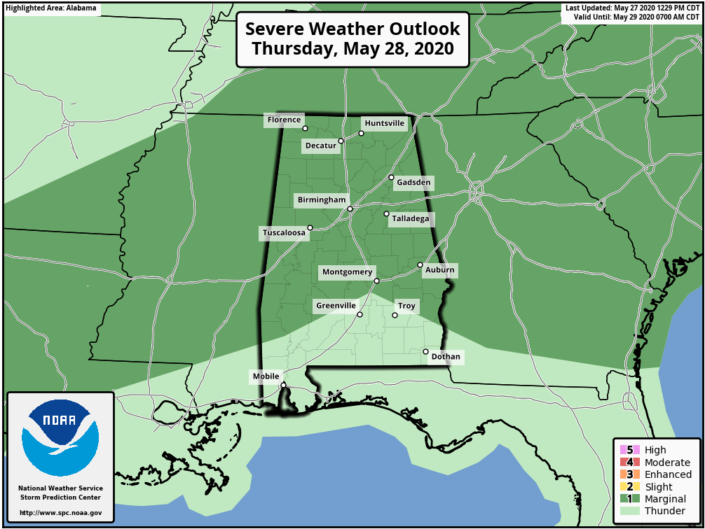
Nearly all of North/Central Alabama will be under a LEVEL 1 MARGINAL RISK for severe storms on Thursday mainly from 1:00 pm until 9:00 pm as damaging winds up to 60 MPH will once again be the main threat. The good news is that the showers and storms will be more isolated to scattered in nature, so you do not have to expect an all-day rain. Highs will range from the lower 80s in the northwest to the upper 80s in the southeast.
Category: Alabama's Weather, ALL POSTS, Severe Weather
About the Author (Author Profile)
Scott Martin is an operational meteorologist, professional graphic artist, musician, husband, and father. Not only is Scott a member of the National Weather Association, but he is also the Central Alabama Chapter of the NWA president. Scott is also the co-founder of Racecast Weather, which provides forecasts for many racing series across the USA. He also supplies forecasts for the BassMaster Elite Series events including the BassMaster Classic.Subscribe
If you enjoyed this article, subscribe to receive more just like it.


