Strong Storms Affecting Lee & Chambers Co.
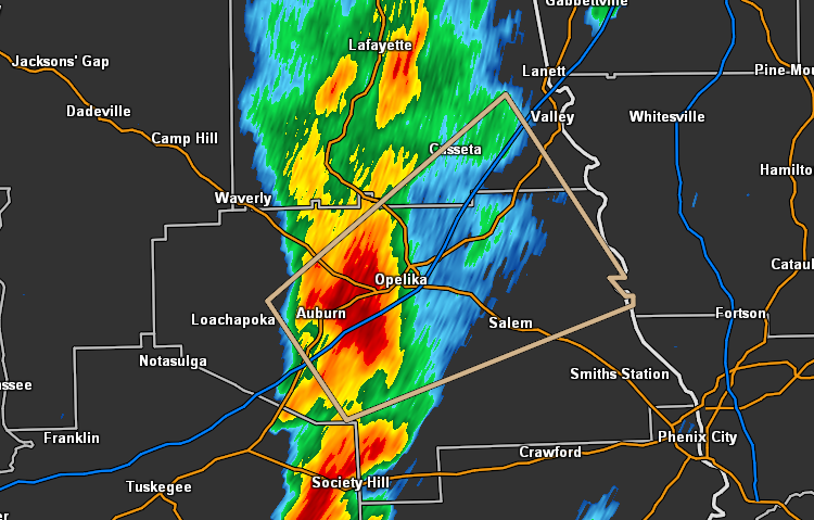
…SIGNIFICANT WEATHER ADVISORY FOR NORTHERN LEE AND SOUTHEASTERN
CHAMBERS COUNTIES UNTIL 700 PM CDT…
At 618 PM CDT, Doppler radar was tracking a strong thunderstorm near
Auburn, moving northeast at 20 mph.
Pea size hail and winds in excess of 40 mph will be possible with
this storm.
Locations impacted include…
Auburn, Opelika, Cusseta, Beulah, Beauregard, Beans Mill, Huguley,
Auburn University, Robert G. Pitts Airport, Chewacla State Park,
Lanett Municipal Airport and Mount Jefferson.
Category: Alabama's Weather, ALL POSTS, Severe Weather
About the Author (Author Profile)
Scott Martin is an operational meteorologist, professional graphic artist, musician, husband, and father. Not only is Scott a member of the National Weather Association, but he is also the Central Alabama Chapter of the NWA president. Scott is also the co-founder of Racecast Weather, which provides forecasts for many racing series across the USA. He also supplies forecasts for the BassMaster Elite Series events including the BassMaster Classic.Subscribe
If you enjoyed this article, subscribe to receive more just like it.


