Mainly Dry at Midday, but a Few Spotty Showers are Out There; Cristobal Downgraded to a Depression for Now
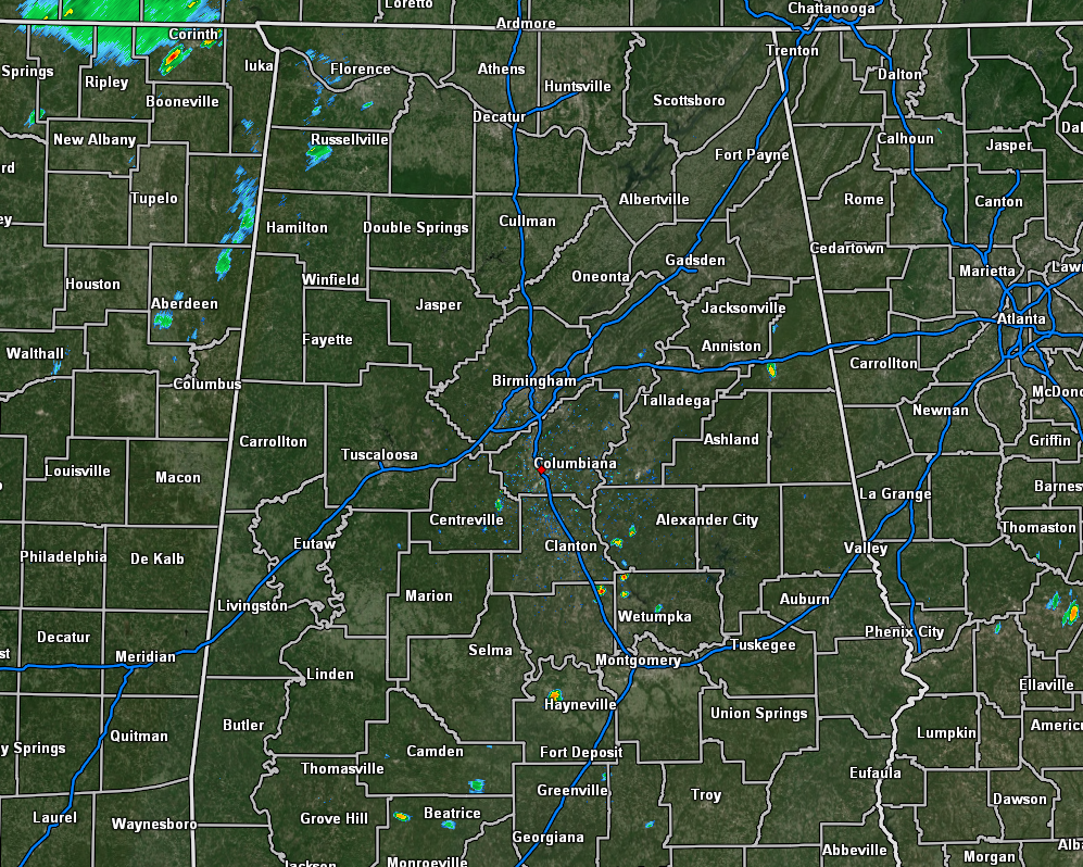
As of 11:15 am, we only have a few light spotty showers over the extreme western part of North Alabama along with a few spotty showers around the I-65 corridor in between I-20 and I-85. The rest of the area is rain-free at this point. Temperatures as of the 11:00 am roundup were in the upper 70s to the mid-80s across the area. Troy was the warm spot at 85 degrees. Marion was the cool spot at 77 degrees. Birmingham was sitting at 79 degrees.
Skies will continue to be partly cloudy but expect a few more clouds to roll in from the west during the afternoon hours. With the heating of the day, we can expect scattered to numerous showers and thunderstorms to form across the area. Just like yesterday, we may have a few that become strong with the potential for one or two to become briefly severe. Gusty winds and small hail will be the main threats. Afternoon highs will range from the lower 80s in the northwest to the upper 80s in the southeast. Much of the activity will begin to die down as we lose the sunlight and much will be gone by the late local news, but we will keep a very small chance of a shower or thunderstorm during the overnight hours. Lows will be in the mid-60s to the lower 70s.
It will be much of the same story for your Friday as we’ll have dry conditions for much of the area during the morning hours, but scattered to numerous showers and thunderstorms can be expected during the afternoon and evening hours. Highs will be in the upper 80s to the lower 90s.
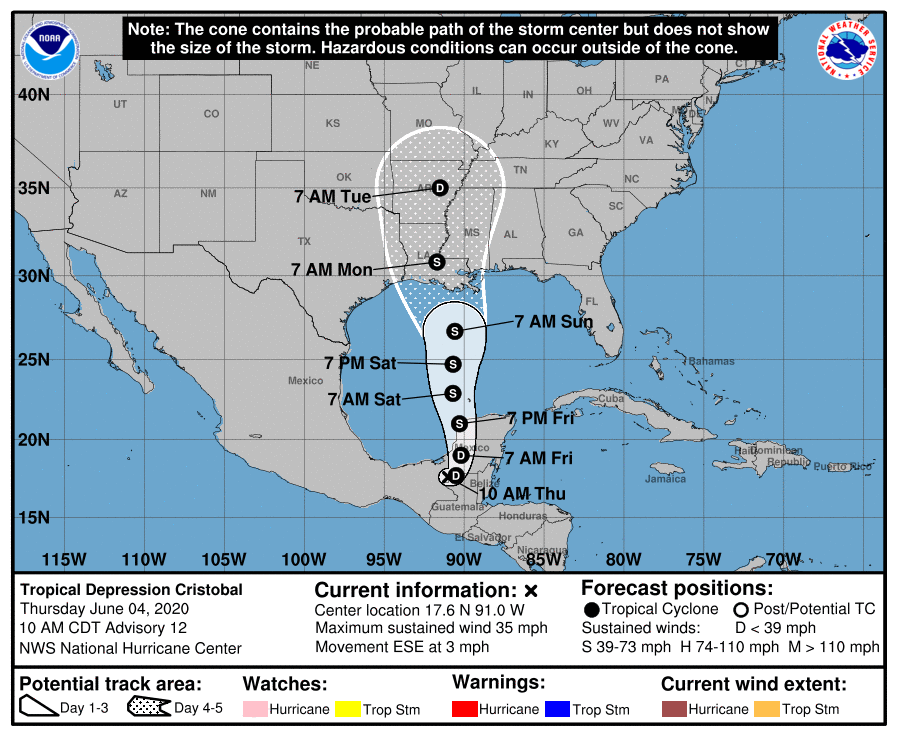
Cristobal has weakened into a tropical depression as of the 10:00 am update and should stay at depression strength through the rest of today and into the morning hours on Friday. The center will eventually move back northward over the Bay of Campeche and should quickly gather strength and become a tropical storm once again. Nearly every model member of the ensembles keep Cristobal at tropical storm strength throughout the trek across the Gulf of Mexico until it makes landfall somewhere on the Gulf Coast.
As of now, the cone is centered on the Louisiana Gulf Coast just south of Patterson, with the outer edge of uncertainty reaching as far west as High island, Texas, and as far east as Biloxi, Mississippi, with landfall forecast sometime between 7:00 pm Sunday to 3:00 am Monday.
For the Alabama and West Florida Gulf Coasts, rip currents have already been an issue and red flags are already up. Those rip currents along with the surf will only become worse throughout the weekend. Some minor coastal flooding may occur due to the onshore flow and the heavy rain that will fall. There will be rain at times along with gusty winds, but those winds should stay just below tropical storm strength if there is no change in the track.
For Central Alabama, we’ll only see an uptick in humidity levels throughout the weekend, but we do not expect to see and tropical rainfall from Cristobal in our neck of the words until late on Sunday and through all of Monday. It will not be a complete rainout but expect rain at any time once that tropical moisture arrives. For Friday and the weekend, expect the same as what we’ll see today, just the potential for scattered afternoon and early evening showers and thunderstorms that you would expect during summertime in Central Alabama.
Category: Alabama's Weather, ALL POSTS, Tropical
About the Author (Author Profile)
Scott Martin is an operational meteorologist, professional graphic artist, musician, husband, and father. Not only is Scott a member of the National Weather Association, but he is also the Central Alabama Chapter of the NWA president. Scott is also the co-founder of Racecast Weather, which provides forecasts for many racing series across the USA. He also supplies forecasts for the BassMaster Elite Series events including the BassMaster Classic.Subscribe
If you enjoyed this article, subscribe to receive more just like it.


