A Late Afternoon Look at Tropical Storm Cristobal
4:00 PM SUMMARY
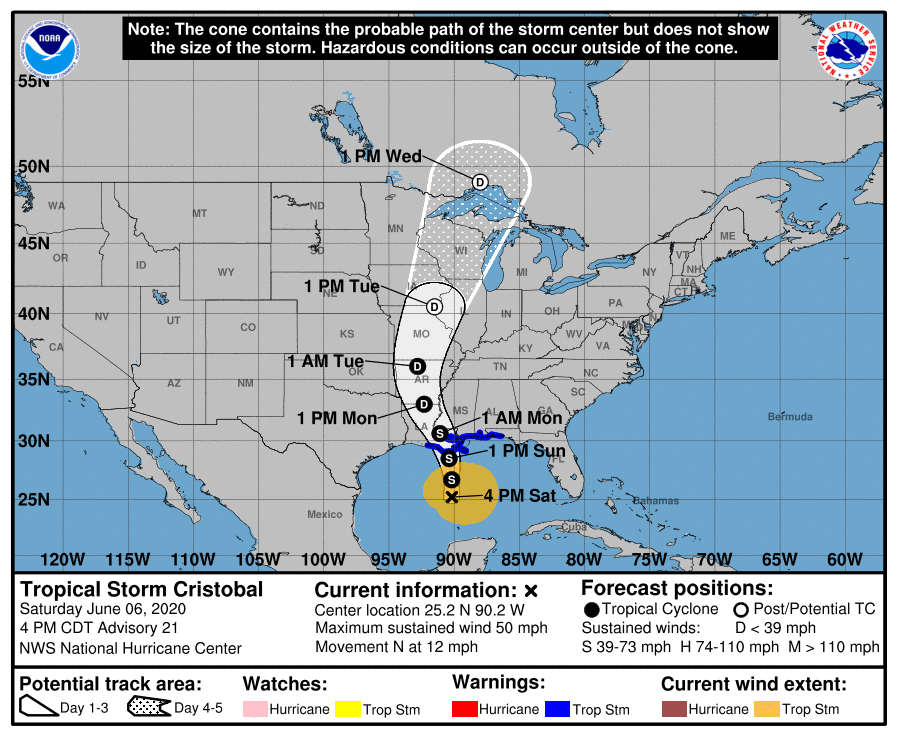
LOCATION: About 250 miles SSW of the mouth of the Mississippi River.
MAXIMUM SUSTAINED WINDS: 50 MPH
MINIMUM CENTRAL PRESSURE: 29.36 in or 994 MB
PRESENT MOVEMENT: North at 12 MPH
WATCHES & WARNINGS
A Storm Surge Warning is in effect for…
* Mouth of the Mississippi River to Ocean Springs Mississippi
* Lake Borgne
A Storm Surge Watch is in effect for…
* East of Morgan City Louisiana to the mouth of the Mississippi River
A Tropical Storm Warning is in effect for…
* Intracoastal City Louisiana to the Okaloosa/Walton County Florida line
* Lake Pontchartrain and Lake Maurepas
4:00 PM FORECAST DISCUSSION
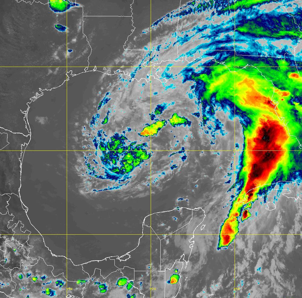
Cristobal continues to lack the appearance and structure of a typical tropical cyclone. In fact, the large radius of maximum wind and convective bands well removed from the center are more characteristic of a subtropical cyclone. Based on earlier Air Force Hurricane Hunter observations, the maximum winds are about 45 kt. The central pressure has held steady during the last couple of fixes of the aircraft mission, suggesting no significant strengthening since this morning. Since the system is not well organized and is likely to continue to ingest some more dry air, only a little more strengthening is expected until landfall. The official intensity forecast is unchanged and remains close to the model consensus.
The cyclone remains on track and is moving northward, or 360/10 kt. The track forecast philosophy remains unchanged. The system should continue northward between two mid-level anticyclones until it nears the northern Gulf coast. After landfall, a slight building of a ridge to the northeast should induce a turn toward the north-northwest. In 3-4 days, the post-tropical cyclone should accelerate north-northeastward ahead of a mid-tropospheric trough. Thereafter, the global models suggest that the system should merge with an extratropical cyclone near the Great Lakes. The official track forecast is in good agreement with the dynamical model consensus and is also close to the latest GFS solution.
Cristobal is likely to remain a broad and asymmetric storm when it makes landfall. Therefore, one should not focus on the exact forecast track, as the associated winds, storm surge, and rainfall will extend well away from the center.
KEY MESSAGES
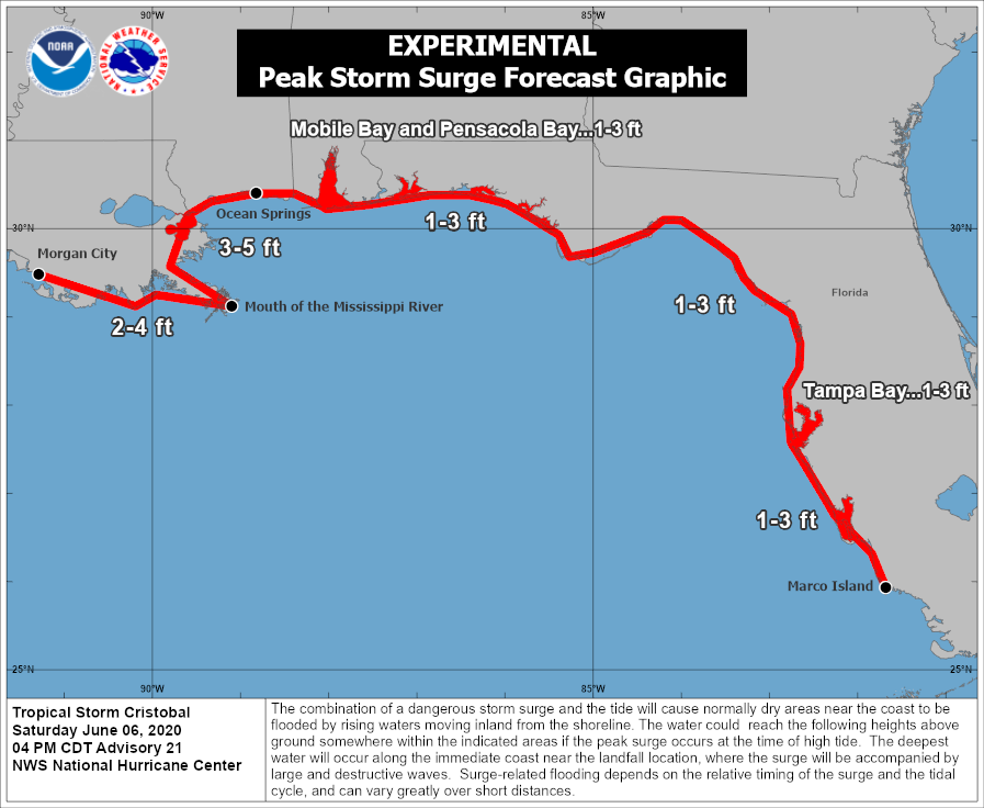
1. There is a danger of life-threatening storm surge outside of the Hurricane and Storm Damage Risk Reduction System from the Mouth of the Mississippi River to Ocean Springs, Mississippi, and a Storm Surge Warning is in effect for those areas. Life-threatening storm surge remains possible in other portions of southern and southeastern Louisiana where a Storm Surge Watch is in effect. Residents in these locations should follow the advice given by local emergency officials.
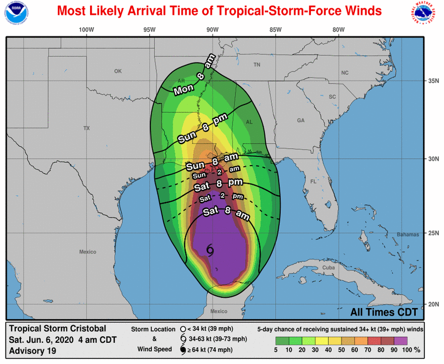
2. Tropical-storm-force winds are expected by late tonight along the northern Gulf Coast from central Louisiana to the western Florida Panhandle, including metropolitan New Orleans, and a Tropical Storm Warning is in effect for this area. These winds will arrive well in advance of and extend well east of Cristobal’s center.
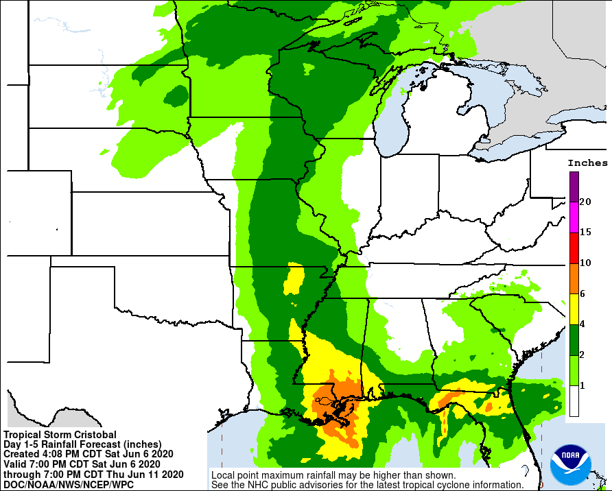
3. Heavy rainfall will continue across west and north Florida today, spreading from east to west across the eastern and central Gulf Coast from the Florida Panhandle into Louisiana today into Sunday. This heavy rain will move into the Lower Mississippi Valley on Monday. Significant flooding will be possible on smaller streams, especially where heavier rainfall occurs over portions of the Gulf Coast and Lower Mississippi Valley.
IMPACTS FOR CENTRAL ALABAMA
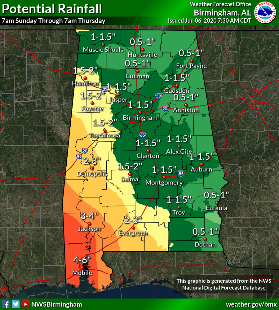
There is a small chance that locally heavy rain may produce some minor flooding late Sunday night into Monday. The area of concern will generally be west of a line from Selma to Tuscaloosa to Hamilton. Rain bands associated with Cristobal will move into Marengo County late Sunday night and then spread to far western areas of Central Alabama on Monday. Rain amounts of 1 to 2 inches are possible with isolated 3-inch amounts not out of the question near the Mississippi and Alabama state line. Any slight westward movement in the path of Cristobal may lower these rain amounts.
There will also be a highly-conditional tornado threat late Sunday night into Monday for those same general locations. There is plenty of uncertainty with this as it will all be dependent on where exactly the final path takes the center of Cristobal and how strong it will be. Nevertheless, the better chances for those brief tropical-type spin-up tornadoes will be close to the Mississippi state line.
We’ll continue to keep you updated… so stay tuned.
Category: Alabama's Weather, ALL POSTS, Severe Weather, Tropical
About the Author (Author Profile)
Scott Martin is an operational meteorologist, professional graphic artist, musician, husband, and father. Not only is Scott a member of the National Weather Association, but he is also the Central Alabama Chapter of the NWA president. Scott is also the co-founder of Racecast Weather, which provides forecasts for many racing series across the USA. He also supplies forecasts for the BassMaster Elite Series events including the BassMaster Classic.Subscribe
If you enjoyed this article, subscribe to receive more just like it.


