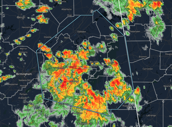
Strong Cluster of Storms Affecting a Good Chunk of the Eastern Parts of Central Alabama
…SIGNIFICANT WEATHER ADVISORY FOR TALLADEGA…RANDOLPH…
SOUTHEASTERN BLOUNT…CALHOUN…NORTHEASTERN SHELBY…ETOWAH…EAST
CENTRAL JEFFERSON…ST. CLAIR…NORTHEASTERN TALLAPOOSA…CLEBURNE…
SOUTHERN CHEROKEE AND CLAY COUNTIES UNTIL 415 PM CDT…
At 323 PM CDT, Doppler radar was tracking strong thunderstorms along
a line extending from near Springville to near Goldville. Movement
was northeast at 25 mph.
Winds in excess of 40 mph will be possible with these storms.
Locations impacted include…
Gadsden, Anniston, Oxford, Trussville, Talladega, Sylacauga, Pell
City, Jacksonville, Leeds, Moody, Rainbow City, Attalla,
Childersburg, Piedmont, Hokes Bluff, Springville, Odenville, Centre,
Heflin and Lineville.
PRECAUTIONARY/PREPAREDNESS ACTIONS…
Torrential rainfall is also occurring with these storms, and may lead
to localized flooding. Do not drive your vehicle through flooded
roadways.
Category: Alabama's Weather, ALL POSTS, Severe Weather


