A Few Spotty Showers At Midday, But Getting Very Warm on This Last Day of Spring
Conditions Across Central Alabama
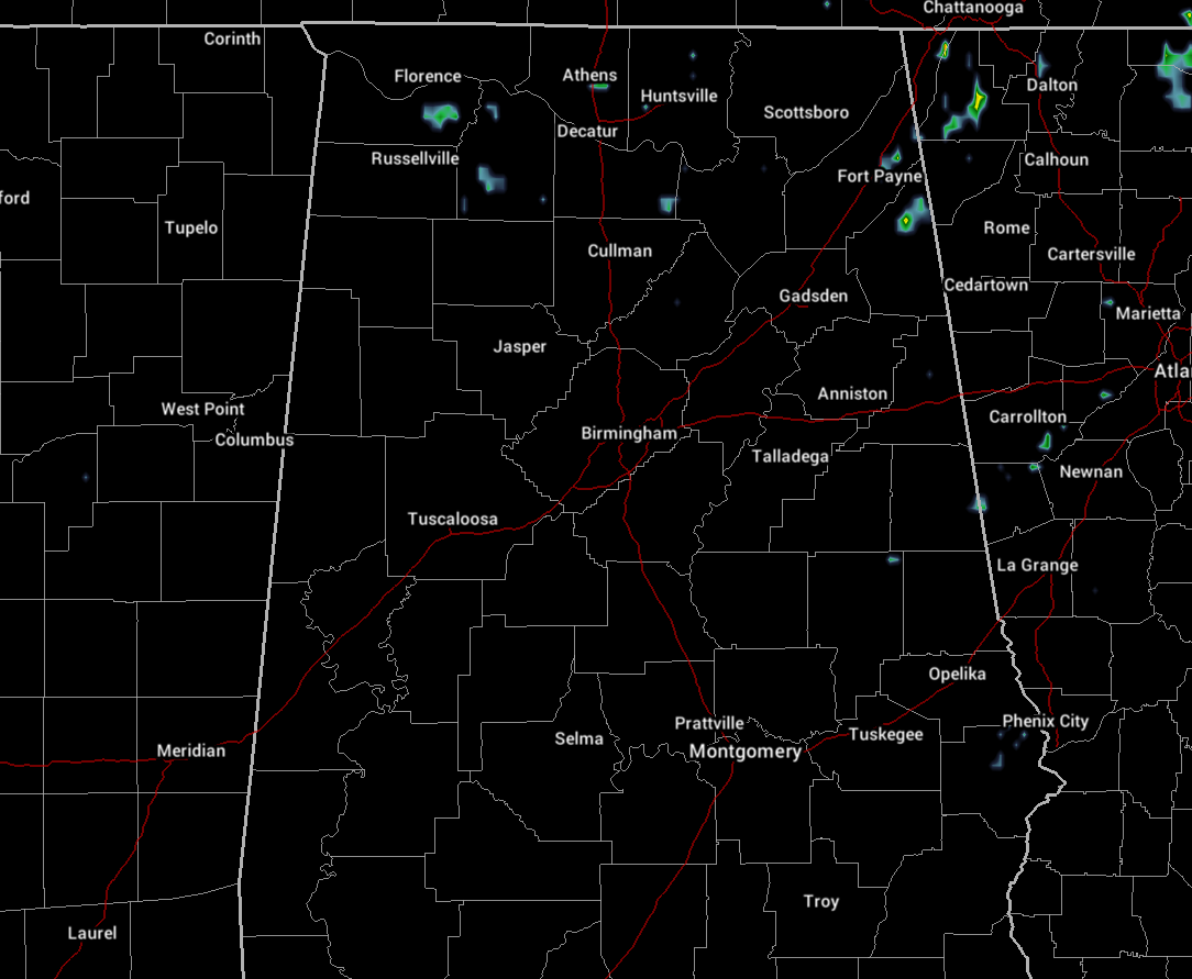
As of 11:38 am on this final full day of spring for 2020, we do have a few spotty showers showing up over North Alabama and into the northern part of Cherokee County in the northeastern part of Central Alabama. The rest of the area is dry at the moment, but that could very easily change over the next few hours. Temperatures as of the 11:00 am round-up were in the upper 70s to the upper 80s across the area. Troy was the warm spot at 88 degrees while Haleyville was the cool spot and the only reporting station in the 70s at 79 degrees. Birmingham was at 84 degrees.
This Afternoon and Early Evening
Skies across the area will feature a mix of sun and clouds with clouds becoming a little more numerous with the heating of the day. Along with the build-up in those clouds, we’ll see the chance of isolated to scattered afternoon showers and thunderstorms rise across the area. Rain chances will be in the 20-30% range from west to east. Most locations in the western and southwestern parts of the area should remain dry. Afternoon highs are expected to top out in the upper 80s to the lower 90s.
Tonight Through the Overnight Hours
Any showers and storms that form during the afternoon and early evening hours will come to an end by the late local news time, but a few isolated showers may linger around the northeastern parts of the area before that point. After that, skies will be partly cloudy to mostly clear but a few areas of patchy fog may form in the northeastern parts of the area. Overnight lows will only drop into the mid-60s to right at or just over 70 degrees.
Dry but Hot Weather for the Start of Summer
That’s right… Saturday will be the start of summertime as the solstice will take place at 4:44 pm CDT… and buddy, Mother Nature is going to make us know summer is here. We’ll start off with a good bit of sunshine, but skies will quickly become mixed with clouds and sun before the midday hour. No rain is expected at this time across Central Alabama, but humidity levels will be high enough that the “feels-like” temperature will be 2-3 degrees warmer than the actual temperatures. Afternoon highs will top out in the lower to mid-90s across the area, but I wouldn’t be surprised to see a location in the southern parts of the area briefly make it up into the upper 90s.
Beach Forecast Center
Get the latest weather and rip current forecasts for the beaches from Bay St. Louis, MS, to Panama City Beach, FL, on our Beach Forecast Center page. There, you can select the forecast of the region that you are interested in.
The Tropics
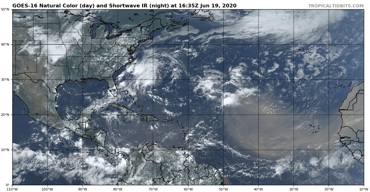
No concerning areas of disturbed weather to worry about across the Atlantic Ocean, the Gulf of Mexico, and the Caribbean Sea at this point. The upper low that was bringing us the excellent weather with the lower humidity values continues to push out to sea east of the Carolinas. The main interest on the satellite image is the dust moving across the Atlantic in the easterlies from Africa. That will eventually work over the Gulf of Mexico and into Central Alabama by the middle of next week. This will actually keep the risks of any tropical development very low as this is very dry air.
On This Day in Weather History
1835 – A tornado tore through the center of New Brunswick NJ killing five persons and scattering debris as far as Manhattan Island. The tornado provided the first opportunity for scientists to study firsthand the track of such a storm.
1972 – Hurricane Agnes moved onshore near Cape San Blas FL with wind gusts to 80 mph, and exited Maine on the 26th. There were 117 deaths, mainly due to flooding from North Carolina to New York State, and total damage was estimated at more than three billion dollars. Up to 19 inches of rain deluged western Schuylkill County PA. The rains of Hurricane Agnes resulted in one of the greatest natural disasters in U.S. history. Agnes caused more damage than all other tropical cyclones in the previous six years combined (which included Celia and Camille).
Category: Alabama's Weather, ALL POSTS, Tropical
About the Author (Author Profile)
Scott Martin is an operational meteorologist, professional graphic artist, musician, husband, and father. Not only is Scott a member of the National Weather Association, but he is also the Central Alabama Chapter of the NWA president. Scott is also the co-founder of Racecast Weather, which provides forecasts for many racing series across the USA. He also supplies forecasts for the BassMaster Elite Series events including the BassMaster Classic.Subscribe
If you enjoyed this article, subscribe to receive more just like it.


