

The Big Picture at 7 p.m.
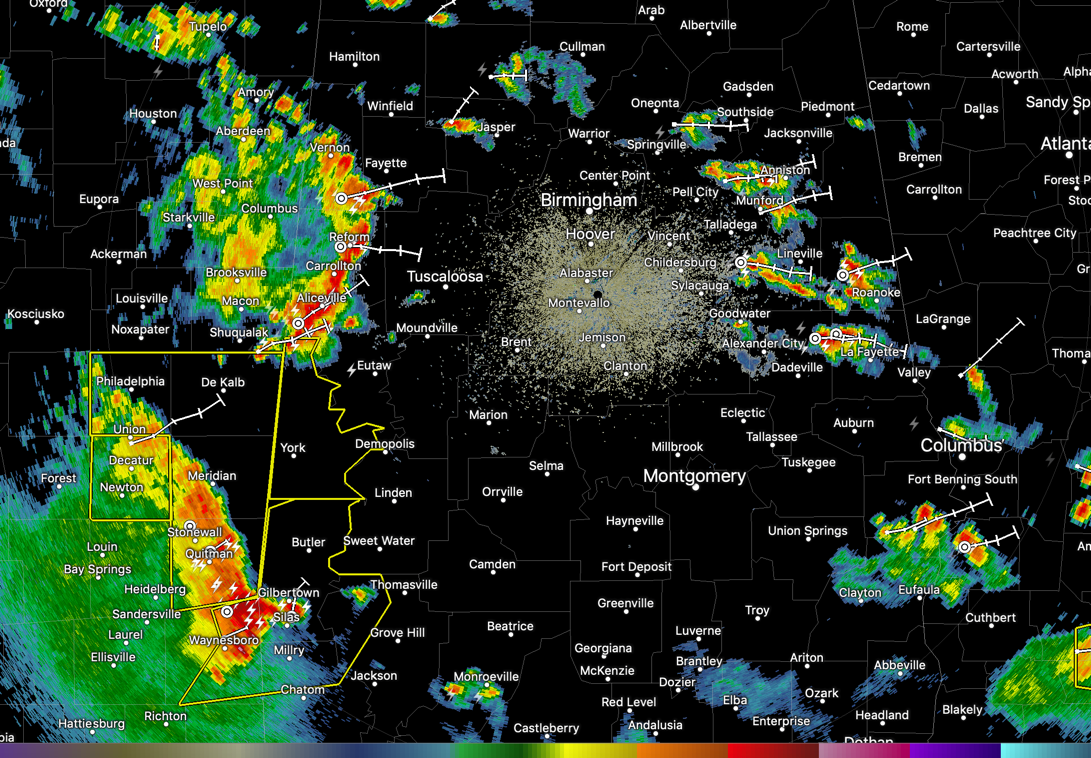
Active storms continue across parts of Alabama tonight. Storms are over East Alabama from Anniston down to Lineville and Roanoke. plenty of lightning with these.
Currently, storms are over Pickens, Tuscaloosa, Hale, and Greene counties. They will reach Tuscaloosa between 7:30-7:45 p.m. They could reach the Birmingham Metro between 8:30-8:45 p.m.
Even stronger storms are approaching West Alabama’s Choctaw and Sumter counties. Severe thunderstorm warnings are in effect for those counties. Damaging wind gusts are possible with the storms for the next couple of hours as they move northeast.
Everything is moving into a fairly unstable airmass and it is being aided by a strengthening low-level jet.
So we will be keeping a close eye on the storms. They should start to weaken after 9 p.m. though.
Category: Alabama's Weather, ALL POSTS, Severe Weather
About the Author (Author Profile)
Bill Murray is the President of The Weather Factory. He is the site's official weather historian and a weekend forecaster. He also anchors the site's severe weather coverage. Bill Murray is the proud holder of National Weather Association Digital Seal #0001 @wxhistorianSubscribe
If you enjoyed this article, subscribe to receive more just like it.


