Storms Over Eastern Alabama
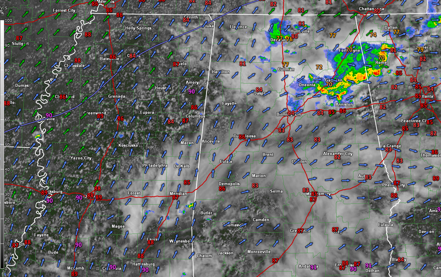
A passing upper-level disturbance is triggering storms over parts of Cherokees, eastern Etowah, northeastern St. Clair, and Calhoun Counties this afternoon.
The heaviest storms extend from Forney in Cherokee County to Hokes Bluff to Ashville down to near Ohatchee and Alexandria.
Light showers extend back into Bount and northeastern Jefferson Counties.
In North Alabam, a storm is along I-565 just east of Decatur in southern Limestone County., with rain covering much of that county.
It is warm and humid across the state, with 80s in most locations except where it has been raining, and readings are in the 70s. Gadsden and Fort Payne have dropped to 70F. Andalusia and Dothan both are posting 91F this hour for the state’s hot spots. Dewpoints are in the muggy middle 70s area-wide making it feel quite uncomfortable. But after all, it is summer in Alabama.
We probably will see a few storms develop over Mississippi this afternoon where skies are partly cloudy and instability values will be approaching 3,000 joules/kg. Temperatures are at or near the point where storms can form there now and they should start o bubble up soon. They will work their way into West Alabama this evening. They will have heavy rain and gusty winds.
We will be watching to see if any of the storms can become severe. There is a marginal (1/5) risk of severe weather across much of the state this afternoon and evening.
Category: Alabama's Weather, ALL POSTS
About the Author (Author Profile)
Bill Murray is the President of The Weather Factory. He is the site's official weather historian and a weekend forecaster. He also anchors the site's severe weather coverage. Bill Murray is the proud holder of National Weather Association Digital Seal #0001 @wxhistorianSubscribe
If you enjoyed this article, subscribe to receive more just like it.


