The Tropics Wanted to Add Some Fireworks to the 4th as a New Depression Forms in The Atlantic
SUMMARY OF 10:00 AM CDT
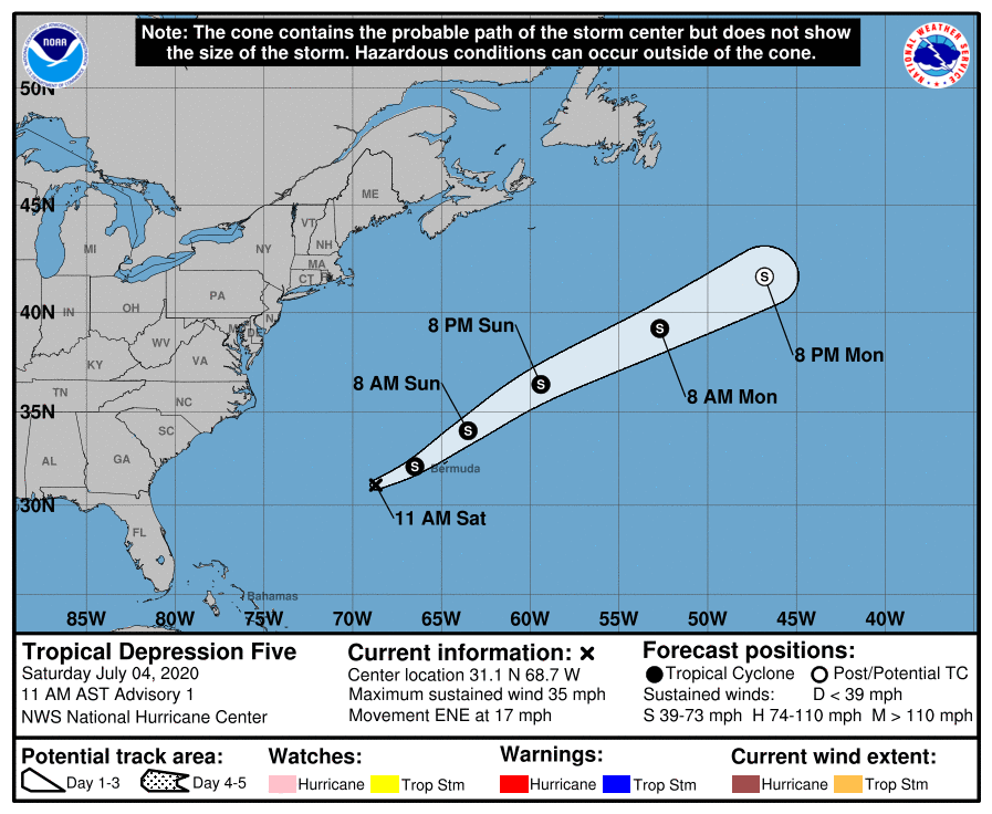
LOCATION…31.1N 68.7W
ABOUT 245 MI…390 KM WSW OF BERMUDA
MAXIMUM SUSTAINED WINDS…35 MPH…55 KM/H
PRESENT MOVEMENT…ENE OR 70 DEGREES AT 17 MPH…28 KM/H
MINIMUM CENTRAL PRESSURE…1009 MB…29.80 INCHES
WATCHES AND WARNINGS
There are no coastal watches or warnings in effect. However, interests in Bermuda should monitor the progress of this system.
FORECAST DISCUSSION
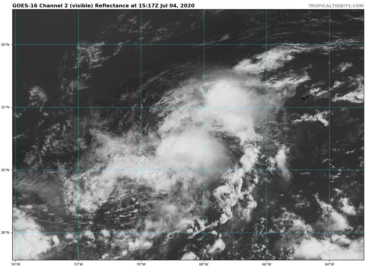
Late Friday, a small low-pressure system developed near the end of a boundary over the western Atlantic. The low persisted overnight while producing convection that has shown increasing signs of organization. Although the low’s center has recently become obscured, earlier one-minute visible imagery confirmed that it is well-defined. The system, therefore, meets the necessary criteria to be designated as a tropical cyclone. A TAFB Dvorak classification of 2.0 is the basis for the 30 kt initial intensity.
The depression is moving quickly toward the east-northeast, caught in the flow between a mid-level ridge to its south and a trough to its north. This steering pattern is expected to be fairly stable for the next day or so, and the guidance is in good agreement that the cyclone will continue on its current general heading with an increase in forward speed during the next couple of days. The NHC track forecast closely follows the TVCN and HCCA consensus aids.
The depression has a sheared appearance, with no convection northwest of its low-level center. A combination of strong upper-level westerly winds and dry mid-level air to the northwest is likely the cause of this, and it is unlikely that the cyclone will get much better organized during the next day or two. That said, some minimal strengthening is possible, even if only due to the expected increase of the cyclone’s forward speed. The NHC intensity forecast is based on a consensus of the HWRF, HMON, and GFS models. It is worth noting that the statistical guidance indicates more strengthening is possible, but this is not currently supported by any dynamical models. There is less agreement on the system’s future beyond the weekend. It could open into a trough and dissipate or persist long enough to undergo extratropical transition. Since this is the first advisory, the official forecast is somewhat conservative and maintains the system as a closed low for 60 h, but it could certainly dissipate sooner than that.
HAZARDS AFFECTING LAND
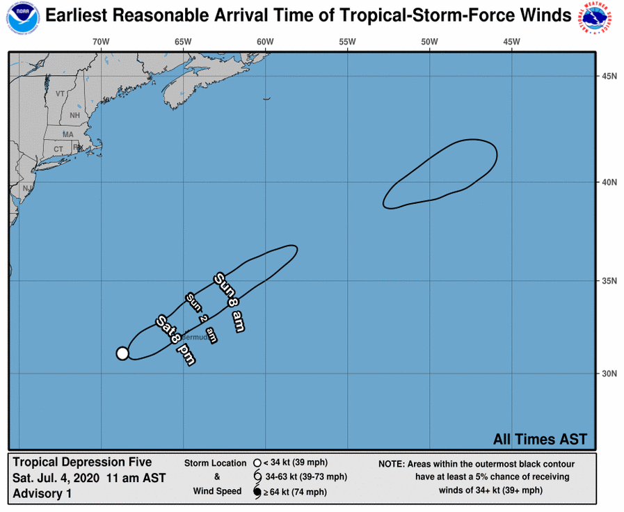
WIND: Tropical Depression Five could cause gusty conditions on Bermuda and over the nearby waters later today or tonight. The Bermuda Weather Service has issued a Gale Warning.
RAIN: Tropical Depression Five is expected to produce total rain
accumulations of less than 1 inch with possible isolated maximum amounts of 4 inches in and around Bermuda.
About the Author (Author Profile)
Scott Martin is an operational meteorologist, professional graphic artist, musician, husband, and father. Not only is Scott a member of the National Weather Association, but he is also the Central Alabama Chapter of the NWA president. Scott is also the co-founder of Racecast Weather, which provides forecasts for many racing series across the USA. He also supplies forecasts for the BassMaster Elite Series events including the BassMaster Classic.Subscribe
If you enjoyed this article, subscribe to receive more just like it.


