An Early Afternoon Look at Central Alabama’s Weather
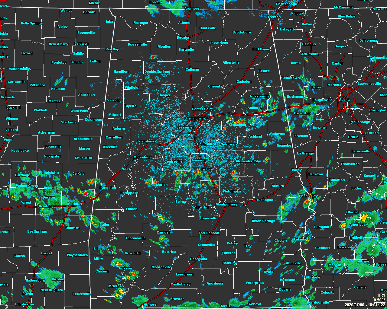
At 1:05 pm, we have scattered showers and storms that have already formed across the south and eastern parts of Central Alabama, especially for locations south and east of the I-59 corridor. So far, everything is staying well-behaved, but I wouldn’t be surprised if we see one or two grow strong this afternoon and into the early evening hours.
Temperatures as of the 1:00 pm Round-Up were in the 80s across the area, ranging from 81 degrees in Sylacauga to 89 degrees in Montgomery and Troy. Birmingham was sitting at 84 degrees.
We have a small low moving through the southeastern parts of Alabama and into the southwestern parts of Georgia and that will provide more than the necessary lift for scattered to numerous showers and thunderstorms to form with the heating of the day. We’ll also see some shower and storm activity work into the eastern parts of the area from Georgia as showers and storms will rotate around the low and move into Central Alabama. While rain will become likely for nearly everyone in the area, the better coverage will be along and south of a line from Greensboro to Jemison to Roanoke. Afternoon highs will be held down a few degrees due to cloud cover and rain, reaching the mid to upper 80s from southeast to northwest.
Scattered showers and storms will continue to be likely across the southern and southeastern parts of the area through the late night and overnight hours, while a few isolated to scattered showers and storms will be possible for the rest of the area. Overnight lows will be in the lower 70s.
Tuesday looks to be a wet day across all of Central Alabama as numerous showers and thunderstorms can be expected throughout the day, but most of the activity will occur during the main heating of the day. Some localized flash flooding issues may occur due to the heavy nature of some storms as precipitable water values look to be around and just above 2 inches. Once again, a few stronger storms will be possible, but widespread severe weather is not expected. Highs will be in the mid to upper 80s.
Category: Alabama's Weather, ALL POSTS
About the Author (Author Profile)
Scott Martin is an operational meteorologist, professional graphic artist, musician, husband, and father. Not only is Scott a member of the National Weather Association, but he is also the Central Alabama Chapter of the NWA president. Scott is also the co-founder of Racecast Weather, which provides forecasts for many racing series across the USA. He also supplies forecasts for the BassMaster Elite Series events including the BassMaster Classic.Subscribe
If you enjoyed this article, subscribe to receive more just like it.


