It’s Hot at Midday… Can We Make a Deal, Mother Nature?

As of 11:20 am, we have mainly sunny skies across the area with only some fair-weather cumulus clouds dotting the blue skies at this point. Unfortunately, those little clouds will not be enough to help with any heat relief. Temperatures as of the 11:00 am Round-Up were already up in the mid-80s to right at 90 degrees. Troy is the hot spot at 90 degrees. The cool spot is the Shelby County Airport (Calera) at 84 degrees. Birmingham was at 86 degrees. Dewpoints are high as well at this time with readings in the mid to upper 70s. That has the heat indices already up into the 91-101 degree range. It’s only going to get hotter today.
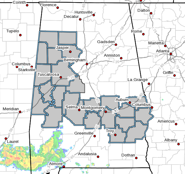
A HEAT ADVISORY goes into effect starting at 1:00 pm for Autauga, Barbour, Bibb, Bullock, Dallas, Elmore, Fayette, Greene, Hale, Lamar, Lee, Lowndes, Macon, Marengo, Marion, Montgomery, Perry, Pickens, Pike, Russell, Sumter, Tuscaloosa, Walker, and Winston counties and is set to expire at 7:00 pm. Heat index values may reach the 101-106 degree range in the advisory area, and with the combination of the high heat and high humidity levels, heat illnesses may occur. Drink plenty of fluids, stay in an air-conditioned room, stay out of the sun, and check up on relatives and neighbors. Young children and pets should never be left unattended in vehicles under any circumstances.
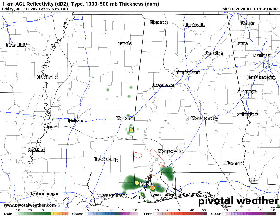
The above animation is only used as a general idea of what to expect for the rest of your Friday. These convection-allowing models do a good job with nearly every situation, but summertime scattered storms are one of the very few weaknesses that these models have.
It will be hot, humid, and partly to mostly sunny through the rest of the daylight hours. There is only a very small risk of isolated showers and thunderstorms across the area, but most locations will stay dry today. Afternoon highs will be in the lower to mid-90s. While a shower or two may linger into the evening hours over the extreme southern parts of Central Alabama, all should be dry by the late local news and skies will clear out for the late-night and overnight hours. Lows will be in the upper 60s to the mid-70s.
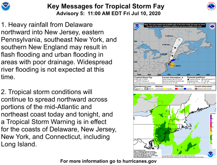
As of the 10:00 am update from the NHC, Tropical Storm Fay has maximum sustained winds at 60 MPH and is moving to the north at 12 MPH. Tropical storm warnings are up on the Atlantic coast from Rhode Island down to Delaware, including Long Island. The center of Fay looks to move inland later this evening around Atlantic City and skirt the coastline and potentially making a second landfall near Newark New Jersey early on Saturday morning. The forecast has Fay beginning a weakening trend later today, but heavy rainfall and strong winds can be expected along the forecast track, especially for Delaware, New Jersey, New York, Connecticut, and even into the extreme eastern parts of Pennsylvania.
Category: Alabama's Weather, ALL POSTS, Tropical
About the Author (Author Profile)
Scott Martin is an operational meteorologist, professional graphic artist, musician, husband, and father. Not only is Scott a member of the National Weather Association, but he is also the Central Alabama Chapter of the NWA president. Scott is also the co-founder of Racecast Weather, which provides forecasts for many racing series across the USA. He also supplies forecasts for the BassMaster Elite Series events including the BassMaster Classic.Subscribe
If you enjoyed this article, subscribe to receive more just like it.


