

EXPIRED Severe Thunderstorm Warning for Winston County Until 12:30 p.m.
The National Weather Service in Birmingham has issued a
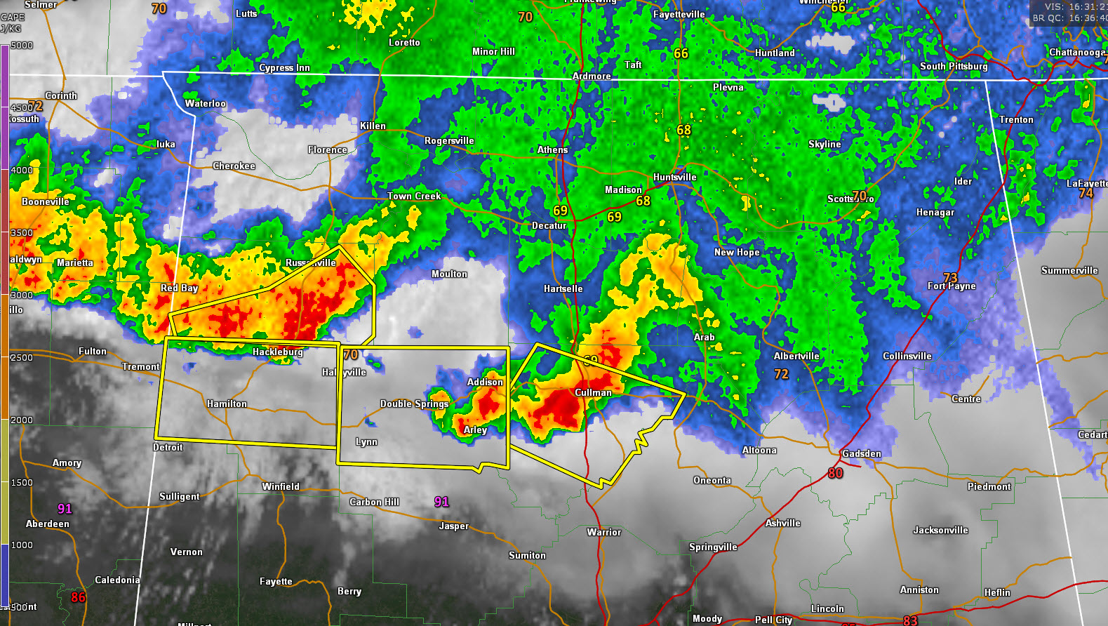
* Severe Thunderstorm Warning for…
Winston County in northwestern Alabama…
* Until 1230 PM CDT.
* At 1137 AM CDT, severe thunderstorms were located along a line
extending from 7 miles northeast of Phil Campbell to near
Hackleburg to 9 miles northwest of Weston, moving southeast at 35
mph.
HAZARD…60 mph wind gusts and quarter size hail.
SOURCE…Radar indicated.
IMPACT…Hail damage to vehicles is expected. Expect wind damage
to roofs, siding, and trees.
* Locations impacted include…
Haleyville, Lynn, Arley, Double Springs, Addison, Nauvoo, Houston
Recreational Area, Camp McDowell, Nesmith, Ashbank, Brushy Lake,
Poplar Springs, Ashridge, Falls City, Moreland, Smith Lake,
Helicon, Inmanfield, Sardis and Corinth Rec Area.
Category: Alabama's Weather, ALL POSTS, Severe Weather
About the Author (Author Profile)
Bill Murray is the President of The Weather Factory. He is the site's official weather historian and a weekend forecaster. He also anchors the site's severe weather coverage. Bill Murray is the proud holder of National Weather Association Digital Seal #0001 @wxhistorianSubscribe
If you enjoyed this article, subscribe to receive more just like it.


