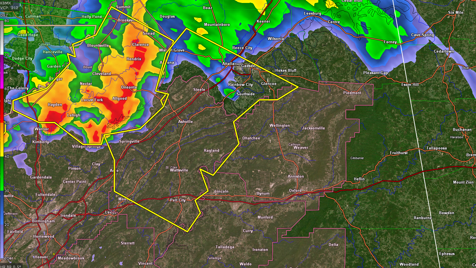
Severe Thunderstorm Warning for Parts of Etowah and St. Clair Counties Until 1:30 p.m.
The National Weather Service in Birmingham has issued a
* Severe Thunderstorm Warning for…
Central Etowah County in northeastern Alabama…
St. Clair County in central Alabama…
* Until 130 PM CDT.
* At 1224 PM CDT, a severe thunderstorm was located over Locust Fork,
or near Cleveland, moving southeast at 30 mph.
HAZARD…60 mph wind gusts and quarter size hail.
SOURCE…Radar indicated.
IMPACT…Hail damage to vehicles is expected. Expect wind damage
to roofs, siding, and trees.
* Locations impacted include…
Gadsden, Pell City, Moody, Rainbow City, Attalla, Hokes Bluff,
Springville, Odenville, Glencoe, Margaret, Argo, Ashville,
Riverside, Ragland, Steele, Altoona, Walnut Grove, Reece City, Bald
Rock and Branchville.
Category: Alabama's Weather, ALL POSTS, Severe Weather
About the Author (Author Profile)
Bill Murray is the President of The Weather Factory. He is the site's official weather historian and a weekend forecaster. He also anchors the site's severe weather coverage. Bill Murray is the proud holder of National Weather Association Digital Seal #0001 @wxhistorianSubscribe
If you enjoyed this article, subscribe to receive more just like it.


