Cloud Penicillin
I always tell you to keep an eye to the sky and you will always have something fun to look at. It doesn’t hurt to have a satellite helping you.
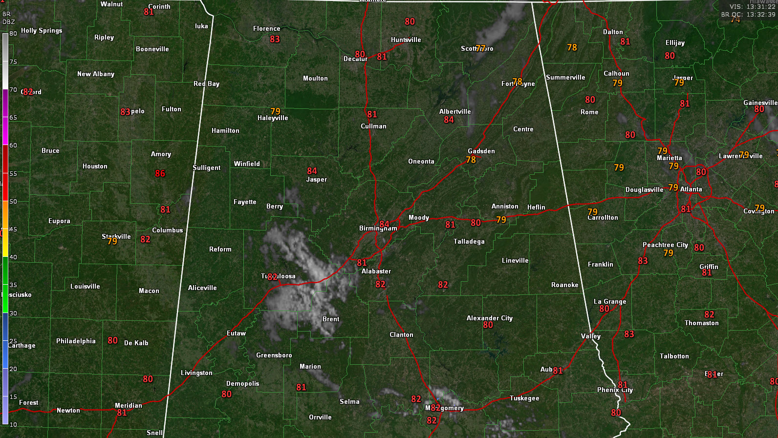
This morning, a little area of maximized instability and lowered lifted condensation levels over western Alabama triggered a mass of clouds. Here is an image from around 8:30.
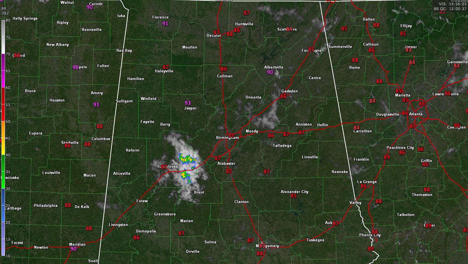
These clouds developed into showers, which developed into storms by 10 a.m.
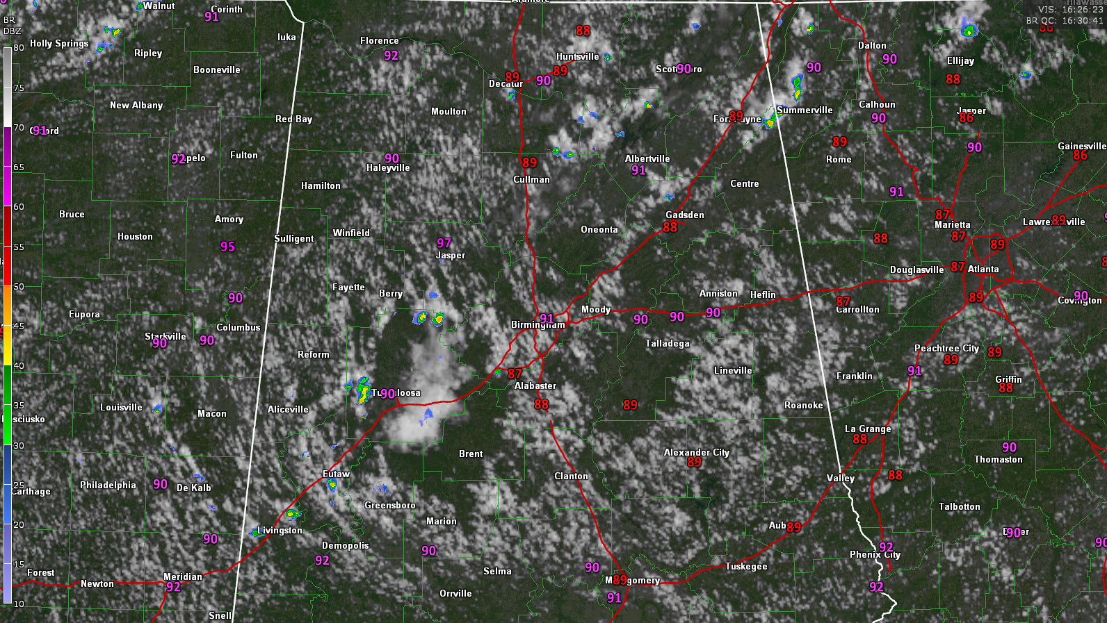
The storms went up quickly, and collapsed just about as quickly, sending out a rush of cooler outflow in all directions. You can see that on this image, as evidenced by the clear air developing out around the dying showers, like a little ring of dead bacteria in a petri dish that has been treated with antibiotics! The outflow is emanating outward like a ripple created when a pebble is dropped into a pond.
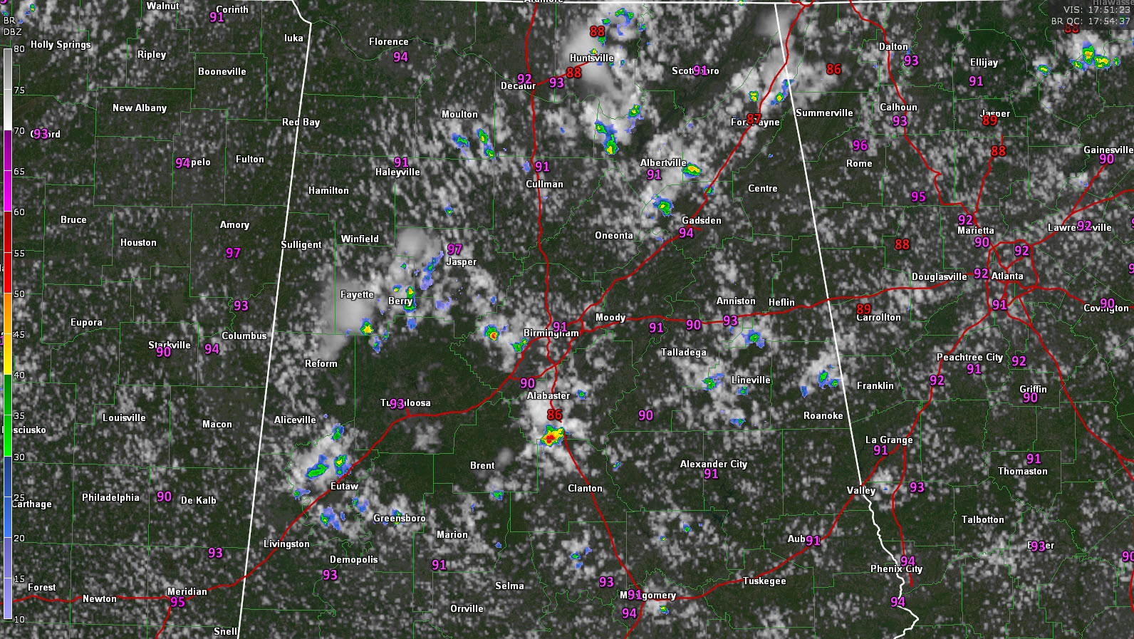
Just before 1 p.m., here is the radar showing a decent cell that has formed just south of the Shelby County Airport near Calera along that outflow. Additional storms will form on this ripple.
Category: Alabama's Weather, ALL POSTS
About the Author (Author Profile)
Bill Murray is the President of The Weather Factory. He is the site's official weather historian and a weekend forecaster. He also anchors the site's severe weather coverage. Bill Murray is the proud holder of National Weather Association Digital Seal #0001 @wxhistorianSubscribe
If you enjoyed this article, subscribe to receive more just like it.


