Hanna Stronger at 10:00 am; Gusty Squalls Occurring Along the Central Texas Coast
SUMMARY OF 1000 AM CDT…1500 UTC…INFORMATION
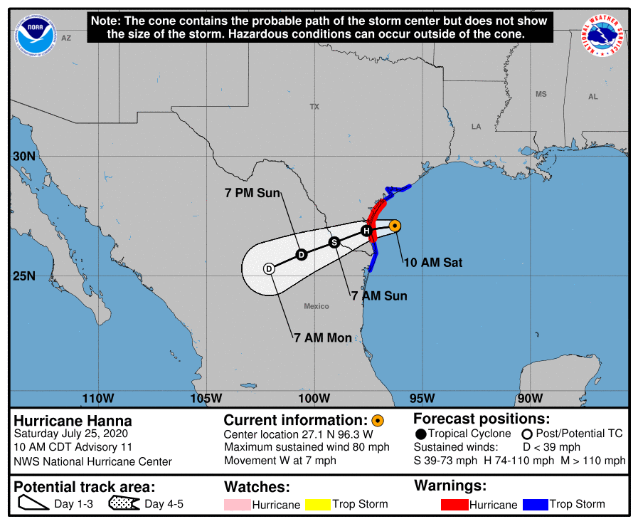
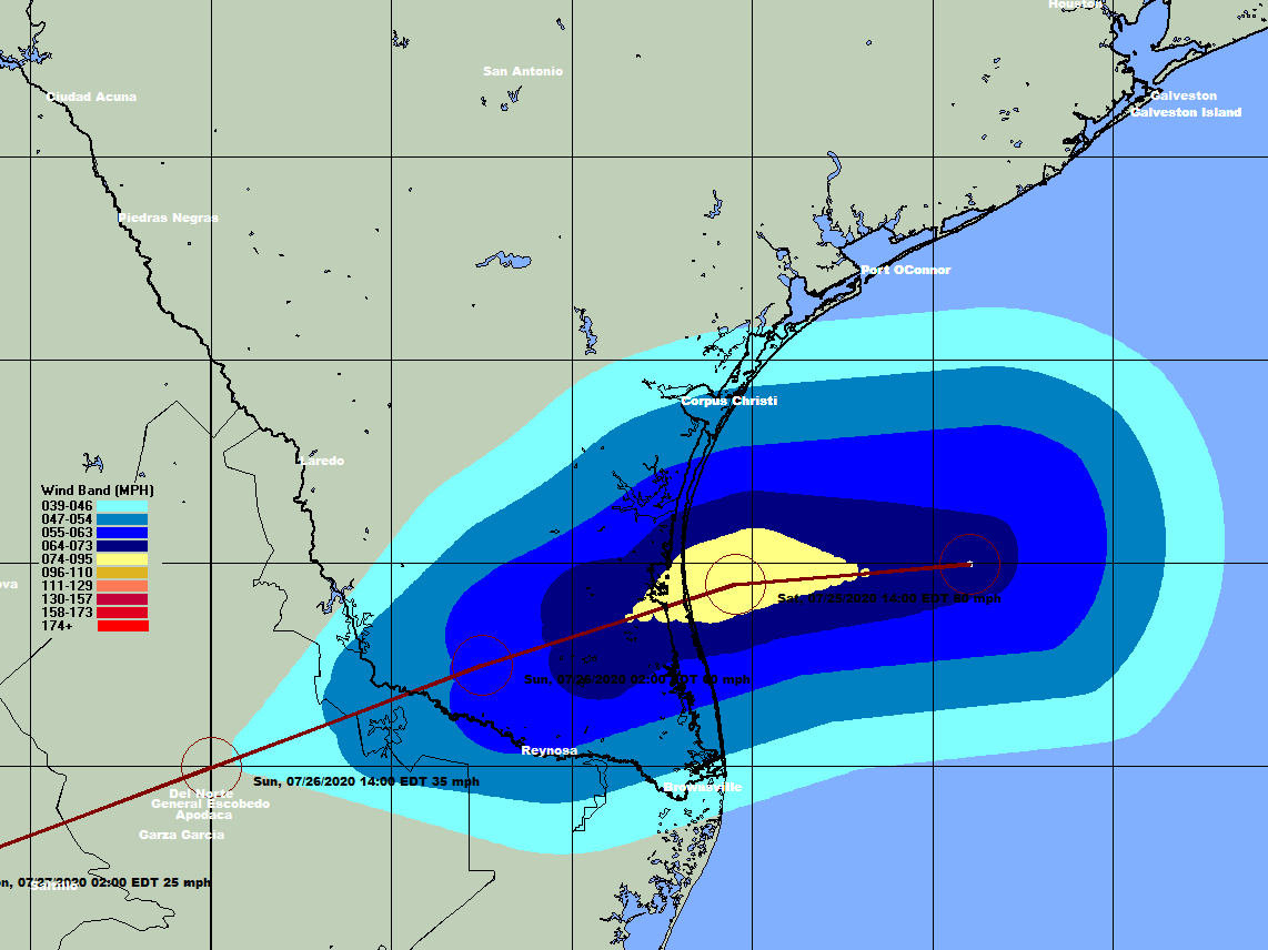
LOCATION…27.1N 96.3W
ABOUT 75 MI…120 KM ENE OF PORT MANSFIELD TEXAS
ABOUT 85 MI…135 KM SE OF CORPUS CHRISTI TEXAS
MAXIMUM SUSTAINED WINDS…80 MPH…130 KM/H
PRESENT MOVEMENT…W OR 270 DEGREES AT 7 MPH…11 KM/H
MINIMUM CENTRAL PRESSURE…978 MB…28.88 INCHES
WATCHES AND WARNINGS
A Storm Surge Warning is in effect for…
* Port Mansfield to Sargent Texas
A Hurricane Warning is in effect for…
* Port Mansfield to Mesquite Bay Texas
A Tropical Storm Warning is in effect for…
* Barra el Mezquital Mexico to Port Mansfield Texas
* Mesquite Bay to Sargent Texas
DISCUSSION AND OUTLOOK
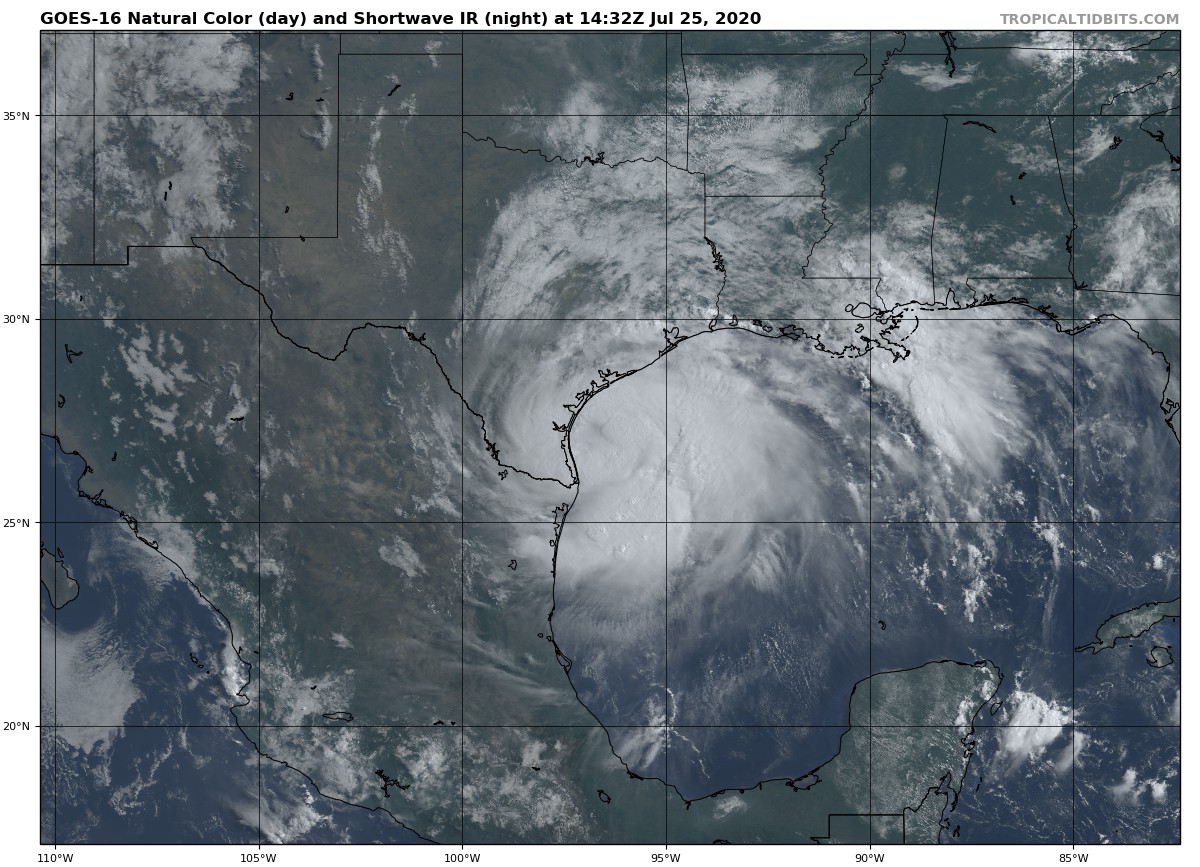
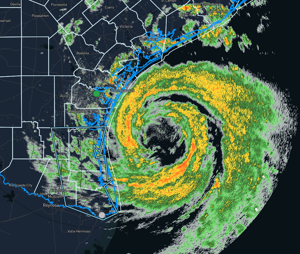
At 1000 AM CDT (1500 UTC), the center of the eye of Hurricane Hanna was located by reconnaissance aircraft and NOAA Doppler weather radars near latitude 27.1 North, longitude 96.3 West. Hanna is moving toward the west near 7 mph (11 km/h), and this motion should continue through this morning. A gradual turn toward the west-southwest is expected by late afternoon and tonight, and that motion should continue through Sunday. On the forecast track, the center of Hanna should make landfall along the Texas coast within the hurricane warning area by late afternoon or early this evening.
Data from the NOAA Hurricane Hunter aircraft and Doppler weather radars indicate that maximum sustained winds have increased to near 80 mph (130 km/h) with higher gusts. Some further strengthening is possible before Hanna makes landfall later today. Rapid weakening is expected after Hanna moves inland.
Hurricane-force winds extend outward up to 25 miles (35 km) from the center and tropical-storm-force winds extend outward up to 90 miles (150 km). Reports from the NOAA Hurricane Hunter aircraft indicate that the minimum central pressure is 978 MB (28.88 inches).
HAZARDS AFFECTING LAND
STORM SURGE: The combination of a dangerous storm surge and the tide will cause normally dry areas near the coast to be flooded by rising waters moving inland from the shoreline. The water could reach the following heights above ground somewhere in the indicated areas if the peak surge occurs at the time of high tide…
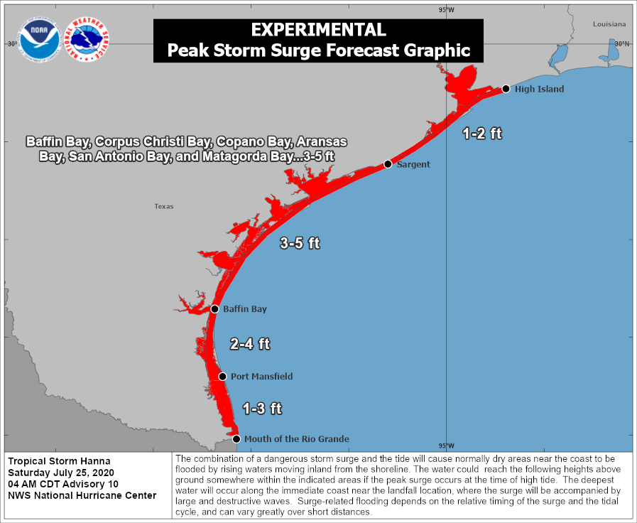
• Baffin Bay to Mesquite Bay including Corpus Christi Bay, Copano Bay, and Aransas Bay…3-5 ft
• Port Mansfield to Baffin Bay…2-4 ft
• Mesquite Bay to Sargent including San Antonio Bay and Matagorda Bay…2-4 ft
• The mouth of the Rio Grande to Port Mansfield…1-3 ft
• North of Sargent to High Island including Galveston Bay…1-2 ft
The deepest water will occur along the immediate coast near and to the right of the landfall location. Surge-related flooding depends on the relative timing of the surge and the tidal cycle and can vary greatly over short distances.
WIND: Hurricane conditions are expected in the warning area this afternoon. Tropical storm conditions are occurring in portions of the warning area and will spread inland through the afternoon and evening.
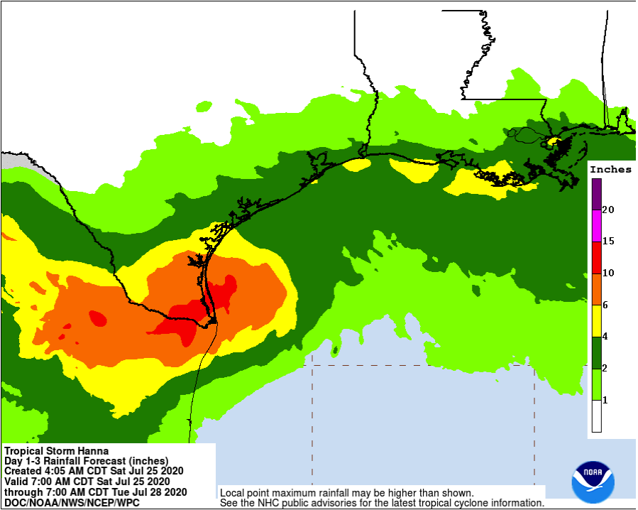
RAINFALL: Hanna is expected to produce 6 to 12 inches of rain with isolated maximum totals of 18 inches through Sunday night in south Texas and into the Mexican states of Coahuila, Nuevo Leon, and northern Tamaulipas. This rain may result in life-threatening flash flooding, rapid rises on small streams, and isolated minor to moderate river flooding in south Texas.
3 to 5 inches of rain is expected along the upper Texas and Louisiana coasts.
SURF: Swells generated by Hanna are expected to increase and affect much of the Texas and Louisiana coasts during the next couple of days. These swells are likely to cause life-threatening surf and rip current conditions.
TORNADOES: A few tornadoes are possible today and overnight over parts of the lower to middle Texas coastal plain.
Category: ALL POSTS, Severe Weather, Tropical
About the Author (Author Profile)
Scott Martin is an operational meteorologist, professional graphic artist, musician, husband, and father. Not only is Scott a member of the National Weather Association, but he is also the Central Alabama Chapter of the NWA president. Scott is also the co-founder of Racecast Weather, which provides forecasts for many racing series across the USA. He also supplies forecasts for the BassMaster Elite Series events including the BassMaster Classic.Subscribe
If you enjoyed this article, subscribe to receive more just like it.


