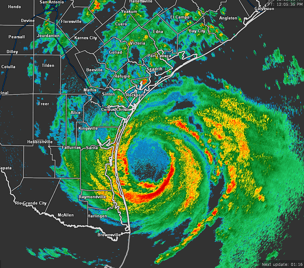
Hurricane Hanna Inches Closer to the Southern Texas Coast at Midday
SUMMARY OF 1200 PM CDT…1700 UTC…INFORMATION
LOCATION…27.0N 96.6W
ABOUT 55 MI…90 KM ENE OF PORT MANSFIELD TEXAS
ABOUT 75 MI…120 KM SE OF CORPUS CHRISTI TEXAS
MAXIMUM SUSTAINED WINDS…80 MPH…130 KM/H
PRESENT MOVEMENT…W OR 270 DEGREES AT 7 MPH…11 KM/H
MINIMUM CENTRAL PRESSURE…977 MB…28.85 INCHES
The latest report from an NOAA National Ocean Service observation platform at Bob Hall Pier on Padre Island recently reported a wind gust of 68 MPH.
NOAA buoy 42020 recently reported a minimum pressure of 978.1 MB (28.88 inches) inside the eye of Hanna.
KEY MESSAGES
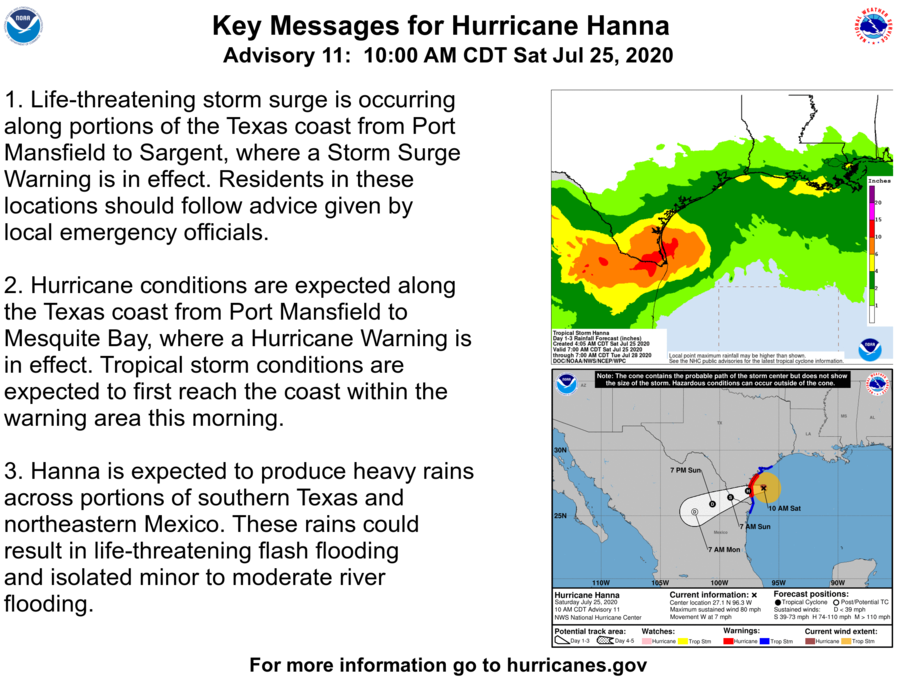
1. Life-threatening storm surge is occurring along portions of the Texas coast from Port Mansfield to Sargent, where a Storm Surge Warning is in effect.
2. Hurricane conditions are expected along the Texas coast from Port Mansfield to Mesquite Bay, where a Hurricane Warning is in effect. Tropical storm conditions are expected to first reach the coast within the warning area this morning.
3. Hanna is expected to produce heavy rains across portions of southern Texas and northeastern Mexico. These rains could result in life-threatening flash flooding and isolated minor to moderate river flooding.
Category: ALL POSTS, Severe Weather, Tropical
About the Author (Author Profile)
Scott Martin is an operational meteorologist, professional graphic artist, musician, husband, and father. Not only is Scott a member of the National Weather Association, but he is also the Central Alabama Chapter of the NWA president. Scott is also the co-founder of Racecast Weather, which provides forecasts for many racing series across the USA. He also supplies forecasts for the BassMaster Elite Series events including the BassMaster Classic.Subscribe
If you enjoyed this article, subscribe to receive more just like it.


