

TD-14 Likely to Become a Tropical Storm Tonight
SUMMARY OF 500 PM EDT…2100 UTC…INFORMATION
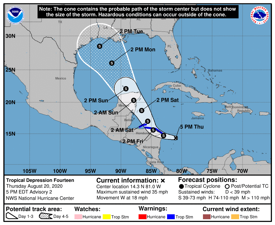
LOCATION…14.3N 81.0W
ABOUT 155 MI…250 KM ESE OF CABO GRACIAS A DIOS ON NIC/HON BORDER
MAXIMUM SUSTAINED WINDS…35 MPH…55 KM/H
PRESENT MOVEMENT…W OR 270 DEGREES AT 18 MPH…30 KM/H
MINIMUM CENTRAL PRESSURE…1007 MB…29.74 INCHES
WATCHES AND WARNINGS
A Tropical Storm Warning is in effect for…
* Honduras/Nicaragua border westward to Punta Castilla Honduras
* Bay Islands of Honduras
* Puerto Cabezas Nicaragua northward to the Honduras/Nicaragua border
Additional watches or warnings, including for the Yucatan Peninsula of Mexico, may be required later this evening or tonight.
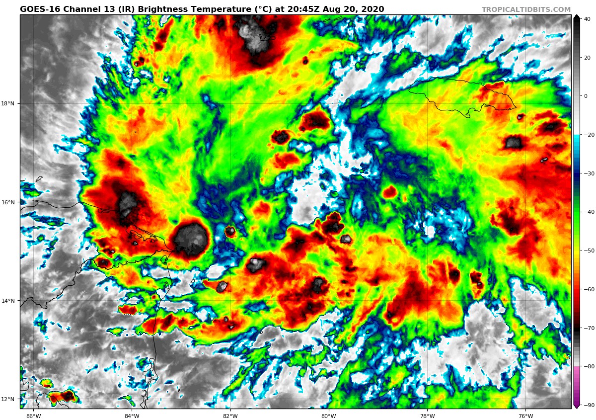
DISCUSSION AND OUTLOOK
At 500 PM EDT (2100 UTC), the center of Tropical Depression Fourteen was located near latitude 14.3 North, longitude 81.0 West. The depression is moving toward the west near 18 mph (30 km/h), and this general motion is expected to continue through tonight. A turn toward the west-northwest and northwest with a decrease in forward speed is forecast on Friday, with a general northwest motion continuing through at least Sunday. On the forecast track, the center of the system will move near or over extreme northern Nicaragua and northeastern Honduras, including the Bay Islands, on Friday and approach the east coast of the Yucatan Peninsula of Mexico on Saturday. The center is then expected to cross the Yucatan Peninsula Saturday night and move into the south-central Gulf of Mexico on Sunday.
Maximum sustained winds are near 35 mph (55 km/h) with higher gusts. Strengthening is forecast during the next couple of days, and the depression is expected to become a tropical storm tonight. The system could be near or at hurricane strength when it reaches the Yucatan Peninsula of Mexico late Saturday.
The estimated minimum central pressure is 1007 MB (29.74 inches).
HAZARDS AFFECTING LAND
WIND: Tropical storm conditions are expected to first reach the coast within the warning area by tonight, making outside preparations difficult or dangerous. These conditions will spread westward along the coast of Honduras within the warning area on Friday.
RAINFALL: The depression is expected to produce the following rainfall accumulations through Sunday:
Eastern portions of the Mexican states of Quintana Roo and Yucatan: 3 to 6 inches, isolated maximum totals of 10 inches. This rainfall may result in areas of flash flooding.
Honduras: 2 to 4 inches.
Jamaica and northern Nicaragua: 1 to 2 inches.
Information taken from the latest National Hurricane Center Public Advisory as of 4:00 pm.
Category: ALL POSTS, Severe Weather, Tropical
About the Author (Author Profile)
Scott Martin is an operational meteorologist, professional graphic artist, musician, husband, and father. Not only is Scott a member of the National Weather Association, but he is also the Central Alabama Chapter of the NWA president. Scott is also the co-founder of Racecast Weather, which provides forecasts for many racing series across the USA. He also supplies forecasts for the BassMaster Elite Series events including the BassMaster Classic.Subscribe
If you enjoyed this article, subscribe to receive more just like it.


