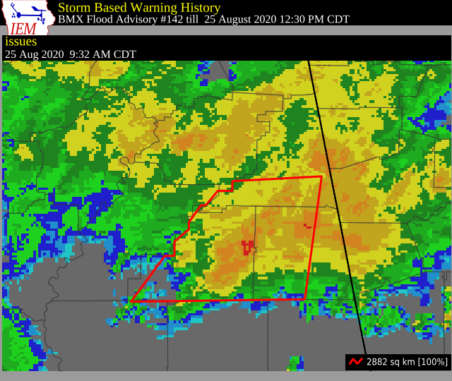
Flood Advisory for Parts of Clay, Cleburne, & Randolph Co. Until 12:30 pm
The National Weather Service in Birmingham has issued a
* Small Stream Flood Advisory for…
Clay County in east central Alabama…
Southern Cleburne County in east central Alabama…
Randolph County in east central Alabama…
* Until 1230 PM CDT.
* At 932 AM CDT, Doppler radar indicated heavy rain has fallen
across the advisory area over the last three hours. This may cause
small stream flooding across portions of Clay, Randolph, and
southern Cleburne County this morning.
Some locations that will experience flooding include…
Lineville, Ashland, Wedowee, Lake Wedowee, Wadley, Woodland,
Barfield, Delta, Corinth, Fosters Cross Roads, Malone, Mount Cheaha,
Morrison Cross Roads, Ofelia, Cragford, R.L. Harris Dam, Mellow
Valley, Camp Sequoyah, Hollis Crossroads and Motley.
PRECAUTIONARY/PREPAREDNESS ACTIONS…
A Flood Advisory means river or stream flows are elevated, or
ponding of water in urban or other areas is occurring or is imminent.
Turn around, don’t drown when encountering flooded roads. Most flood
deaths occur in vehicles.
Excessive runoff from heavy rainfall will cause flooding of small
creeks and streams, country roads, farmland, and other low lying
spots.
Category: Alabama's Weather, ALL POSTS, Severe Weather
About the Author (Author Profile)
Scott Martin is an operational meteorologist, professional graphic artist, musician, husband, and father. Not only is Scott a member of the National Weather Association, but he is also the Central Alabama Chapter of the NWA president. Scott is also the co-founder of Racecast Weather, which provides forecasts for many racing series across the USA. He also supplies forecasts for the BassMaster Elite Series events including the BassMaster Classic.Subscribe
If you enjoyed this article, subscribe to receive more just like it.


