Noon Notes on Laura
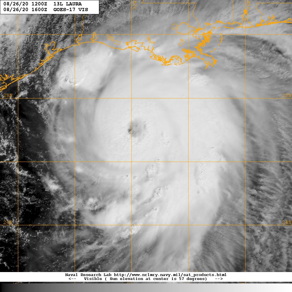
Hurricane Laura continues to strengthen this afternoon. Top winds are 125 mph, at the top of the category 3 level. At 130 mph, it will be a cat 4.
It is moving northwest at 19 mph. You are beginning to see the wobbles to the left and right that make up a hurricane’s motion. If you extrapolate the motion of the ye, it looks like it will get dangerously close to Houston, but it should continue to turn to the north northwest in coming hours.
It is expect to make landfall between High Island and Grand Chenier just after midnight tonight, likely near Cameron, LA, a place made famous by Hurricane Audrey in 1957, one of the deadliest hurricanews to hit the U.S.
The NOAA Hurricane Hunters just departed Laura and Air Force 307, Mission 23 into Laura is just about on station and will be providing fixes this afternoon.
The eye appears to be shrinking on the Lake Charles radar, indicating the storm conintues to wrap up more tightly. We could see an eyewall replacement before landfall, which wold halt the intensification, but there is not much time. The dry air that was impinging on the storm yestterday now is running into an inpenetrable wall around the center.
The surge foreasts have been increased.
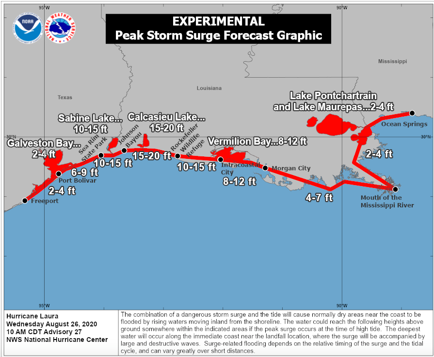
The NHC said:
Unsurvivable storm surge with large and destructive waves will cause
catastrophic damage from Sea Rim State Park, Texas, to Intracoastal
City, Louisiana, including Calcasieu and Sabine Lakes. This storm
surge could penetrate up to 30 miles inland from the immediate
coastline in southwestern Louisiana and far southeastern Texas.
Water levels are rising all along the Louisiana coast. Images of flooding are coming in from places like Golden Meadow in southern Lafourche Parish, at least 185 miles east of where the center where coome inland.
AN OMINOUS NOTE: The NWS Lake Charles has left the building. All of their forecasting and warning responsibilities have been transferred to Brownsville.
NOON COASTAL OBSERVATIONS:
CITY SKY/WX TMP DP RH WIND PRES REMARKS
BEAUMONT CLOUDY 90 77 65 NE21G33 29.83S HX 103
SALT POINT N/A 77 76 96 SE20G47 29.83R
GALVESTON CLOUDY 88 79 74 NE21G26 29.83S HX 103
About the Author (Author Profile)
Bill Murray is the President of The Weather Factory. He is the site's official weather historian and a weekend forecaster. He also anchors the site's severe weather coverage. Bill Murray is the proud holder of National Weather Association Digital Seal #0001 @wxhistorianSubscribe
If you enjoyed this article, subscribe to receive more just like it.


