

Strong Storms Moving into the Birmingham Metro from the Southwest
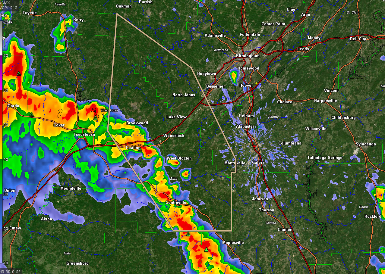
…SIGNIFICANT WEATHER ADVISORY FOR SOUTH CENTRAL WALKER…EASTERN
TUSCALOOSA…SOUTHWESTERN SHELBY…BIBB AND SOUTHWESTERN JEFFERSON
COUNTIES UNTIL 300 PM CDT…
At 216 PM CDT, Doppler radar was tracking strong thunderstorms along
a line extending from near Deerlick Creek Campgrounds to near West
Blocton to Lawley. Movement was north at 30 mph.
Winds in excess of 40 mph will be possible with these storms.
Locations impacted include…
Bessemer, Montevallo, Brent, Centreville, Lake View, Brookwood,
Coaling, Vance, Woodstock, West Blocton, Wilton, North Johns, Bull
City, Lake Wildwood, Brierfield Ironworks Park, University Of
Montevallo, Talladega National Forest, Mercedes Benz Of Alabama,
Eoline and North Bibb.
PRECAUTIONARY/PREPAREDNESS ACTIONS…
To report severe weather, contact your nearest law enforcement
agency. They will relay your report to the National Weather Service
office in Birmingham.
Category: Alabama's Weather, ALL POSTS
About the Author (Author Profile)
Bill Murray is the President of The Weather Factory. He is the site's official weather historian and a weekend forecaster. He also anchors the site's severe weather coverage. Bill Murray is the proud holder of National Weather Association Digital Seal #0001 @wxhistorianSubscribe
If you enjoyed this article, subscribe to receive more just like it.


