While Laura is Losing Tropical Characteristic, A Few Tornadoes May Be Possible Over Portions of the Southeast
NHC UPDATE SUMMARY OF 10:00 AM CDT INFORMATION
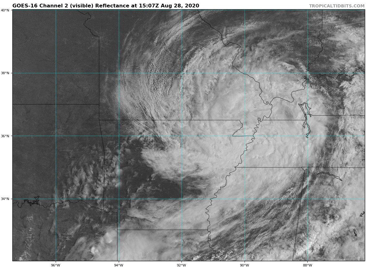
LOCATION: 85 miles northwest of Memphis, Tennessee
MAXIMUM WINDS: 30 mph
MOVEMENT: east-northeast at 20 MPH
MINIMUM PRESSURE: 1001 MB or 29.56 in
WATCHES AND WARNINGS
Flash Flood Watches are posted for portions of Northeast Arkansas, Southeast Missouri, Western Kentucky and Tennessee, Northern Mississippi, and Northwest Alabama.
DISCUSSION AND OUTLOOK
At 1000 AM CDT (1500 UTC), the center of Tropical Depression Laura was located near latitude 36.6 North, longitude 90.5 West. The depression is moving toward the east-northeast near 20 mph (31 km/h) and this motion is expected to continue as Laura tracks along and south of the Ohio Valley through tonight.
Maximum sustained winds are near 30 mph (45 km/h) with higher gusts. Eventually, the remains of Laura will cross the central Appalachians Saturday, before becoming absorbed by an approaching cold front that is forecast to move off the mid-Atlantic coastline by late Saturday.
The estimated minimum central pressure is 1001 MB (29.56 inches).
HAZARDS AFFECTING LAND
RAINFALL: Expect 1 to 3 inches, with isolated 5-inch totals from western and central Kentucky and Tennessee into northern Alabama and Mississippi. One to 2 inches, with isolated 4-inch totals, are possible over southern parts of Louisiana, Mississippi, and Alabama. By Saturday, 1 to 3 inches of rain is forecast from the central and southern Appalachians to the mid-Atlantic states.
This rainfall will continue to contribute to isolated flash and urban flooding, and overflow of small streams and creeks across the aforementioned regions. Minor to moderate river flooding is occurring or forecast in Louisiana and Arkansas.
WIND: Gusty winds of 25-30 mph will accompany Laura’s circulation as it moves toward the Lower Ohio Valley through the afternoon. Stronger gusts are possible within thunderstorms.
TORNADOES: A few tornadoes remain possible, mainly over parts of Mississippi, Tennessee and southern Kentucky. The risk for a couple of tornadoes should redevelop Saturday afternoon and evening over parts of the mid-Atlantic from Virginia to North Carolina.
Category: Alabama's Weather, ALL POSTS, Severe Weather, Tropical
About the Author (Author Profile)
Scott Martin is an operational meteorologist, professional graphic artist, musician, husband, and father. Not only is Scott a member of the National Weather Association, but he is also the Central Alabama Chapter of the NWA president. Scott is also the co-founder of Racecast Weather, which provides forecasts for many racing series across the USA. He also supplies forecasts for the BassMaster Elite Series events including the BassMaster Classic.Subscribe
If you enjoyed this article, subscribe to receive more just like it.


