A Slight Risk Continues for Parts of North/Central Alabama Through Tonight
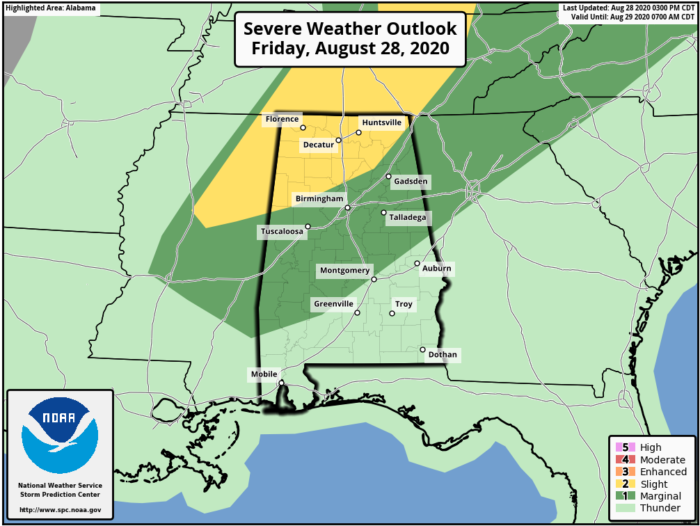
A Slight Risk for severe storms continues through the rest of your Friday for nearly all of North Alabama and for a good part of the northwest quarter of Central Alabama (mainly north of a line from Bethleham (northern Pickens Co.) to just north of Cleveland (central Blount Co.) to just south of Shiloh (extreme northern Dekalb Co.).
A Marginal Risk continues south of the Slight Risk to as far south as Hayneville (central Lowndes Co.) to Reeltown (south-central Tallapoosa Co.) to Five Points (northeastern Chambers Co.)
Strong to severe thunderstorms may be possible from now through 10:00 pm tonight for the locations within the risk area. A brief spin-up tornado and damaging wind gusts up to 60 MPH may be possible with any stronger to severe storm.
Category: Alabama's Weather, ALL POSTS, Severe Weather
About the Author (Author Profile)
Scott Martin is an operational meteorologist, professional graphic artist, musician, husband, and father. Not only is Scott a member of the National Weather Association, but he is also the Central Alabama Chapter of the NWA president. Scott is also the co-founder of Racecast Weather, which provides forecasts for many racing series across the USA. He also supplies forecasts for the BassMaster Elite Series events including the BassMaster Classic.Subscribe
If you enjoyed this article, subscribe to receive more just like it.


