TD-15 Continues to Slowly Move Farther Away From the US Mainland; Expected to Stay a Depression
NHC UPDATE SUMMARY OF 10:00 AM CDT INFORMATION
LOCATION: 140 miles east-southeast of Cape Hatteras, North Carolina
MAXIMUM WINDS: 35 mph
MOVEMENT: east-northeast at 14 MPH
MINIMUM PRESSURE: 1008 MB or 29.77 in
WATCHES AND WARNINGS
There are no coastal watches or warnings in effect.
DISCUSSION AND OUTLOOK
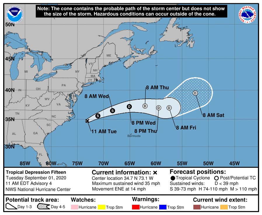
At 1100 AM EDT (1500 UTC), the center of Tropical Depression Fifteen was located near latitude 34.7 North, longitude 73.1 West. The depression is moving toward the east-northeast near 14 mph (22 km/h). This general motion is forecast today, followed by a turn toward the east by Thursday. On the forecast track, the center of the depression will continue to move away from the North Carolina coast today.
Maximum sustained winds remain near 35 mph (55 km/h) with higher gusts. The depression could become a tropical storm later today or tonight. Gradual weakening is anticipated by late Wednesday. The system is forecast to become a remnant low on Thursday.
The estimated minimum central pressure is 1008 MB (29.77 inches).
HAZARDS AFFECTING LAND
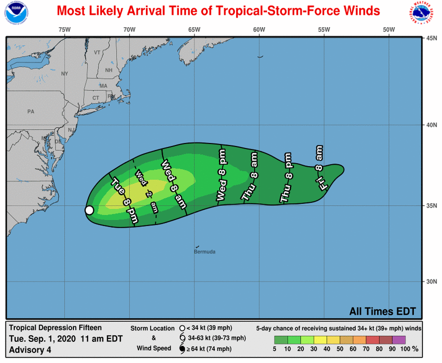
SURF: Swells generated by the depression will continue to affect portions of the Outer Banks of North Carolina through this evening, causing life-threatening surf and rip current conditions.
About the Author (Author Profile)
Scott Martin is an operational meteorologist, professional graphic artist, musician, husband, and father. Not only is Scott a member of the National Weather Association, but he is also the Central Alabama Chapter of the NWA president. Scott is also the co-founder of Racecast Weather, which provides forecasts for many racing series across the USA. He also supplies forecasts for the BassMaster Elite Series events including the BassMaster Classic.Subscribe
If you enjoyed this article, subscribe to receive more just like it.


