Not Too Bad Out There at Midday… Plenty of Sun & Warm
WHAT’S GOING ON OUTSIDE YOUR WINDOW AT 11:45 AM
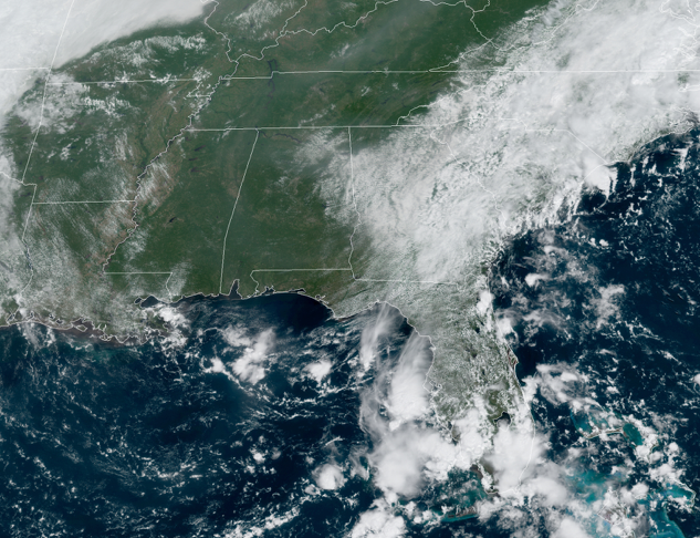
Skies are sunny for most of Central Alabama as we approach the midday hour, but we do see some clouds moving over the eastern parts of the area. No rain on radar and it should mainly stay that way for the remainder of the day with the exception of a shower or two down in the extreme southeast corner of the area. Temperatures as of the official 11:00 am roundup were in the upper 70s to the mid-80s. Birmingham was at 81 degrees. The cool spot was Pell City at 79 degrees. The warm spot was Montgomery at 85 degrees.
WEATHER FOR THE REST OF YOUR WEDNESDAY
The rest of your afternoon and into the early evening hours will be mostly sunny and hot with afternoon highs reaching the upper 80s to the lower 90s across Central Alabama. There is a very small chance for a brief shower or two in the extreme southeastern parts of the area mainly east of a line from Auburn to Troy, but the rest will stay dry. Skies will be mostly clear throughout the late night and overnight hours with lows dropping into the upper 60s to the lower 70s.
RAIN CHANCES ARE BACK FOR YOUR THURSDAY
An easterly flow will allow for moisture from the Atlantic to creep into Central Alabama. As that moisture increases, we will see shower and thunderstorm chances increase not only for your Thursday but for Friday through the weekend as well. There will be a decent chance for scattered showers and thunderstorms for locations in the eastern 2/3rds of Central Alabama while chances will be slim in the west. Thursday’s highs will top out in the upper 80s to the lower 90s.
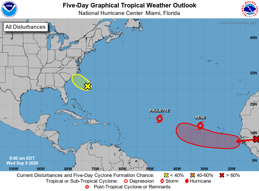
THE TROPICS REMAINING RATHER BUSY
Tropical storms Paulette and Rene continue to move slowly west-northwestward across the east-central and eastern tropical Atlantic Ocean, but will eventually curve away from any land and mainly become “fish storms.”
We also have a small area of low pressure located about 375 miles southeast of Wilmington, North Carolina, continues to produce minimal shower and thunderstorm activity near its center of circulation. The low is forecast to move northwestward at 10 to 15 mph, and some development is possible before it moves inland over eastern North Carolina Thursday afternoon. Interests along the coasts of North and South Carolina should continue to monitor the progress of this disturbance.
* Formation chance through 48 hours…low…30 percent.
* Formation chance through 5 days…low…30 percent.
Another tropical wave is forecast to emerge off the west coast of Africa on Thursday. Gradual development is expected once the system moves over water, and a tropical depression is likely to form late this week or over the weekend while the system moves generally westward across the eastern tropical Atlantic.
* Formation chance through 48 hours…medium…40 percent.
* Formation chance through 5 days…high…80 percent.
Category: Alabama's Weather, ALL POSTS, Tropical
About the Author (Author Profile)
Scott Martin is an operational meteorologist, professional graphic artist, musician, husband, and father. Not only is Scott a member of the National Weather Association, but he is also the Central Alabama Chapter of the NWA president. Scott is also the co-founder of Racecast Weather, which provides forecasts for many racing series across the USA. He also supplies forecasts for the BassMaster Elite Series events including the BassMaster Classic.Subscribe
If you enjoyed this article, subscribe to receive more just like it.


