Tropical Update

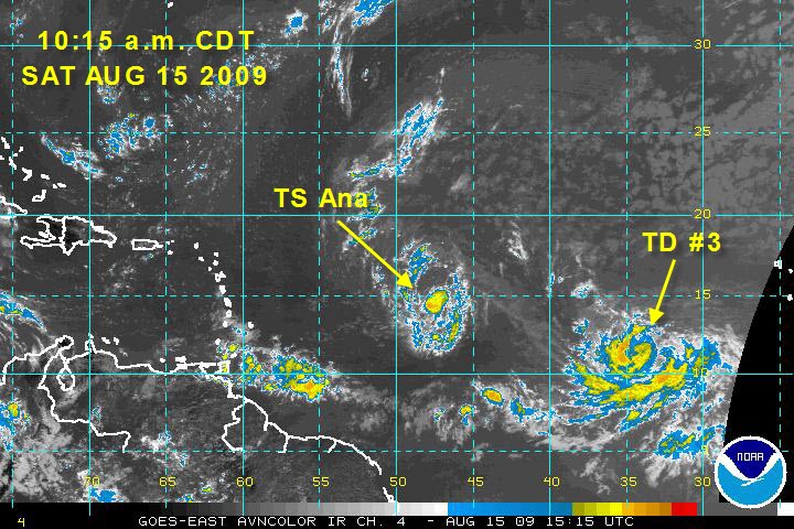
Tropical depression two became tropical storm Ana this morning. Tropical depression three also formed.
The proximity of the two systems will lead to some interesting interactions.
A FEW NOTES:
ANA
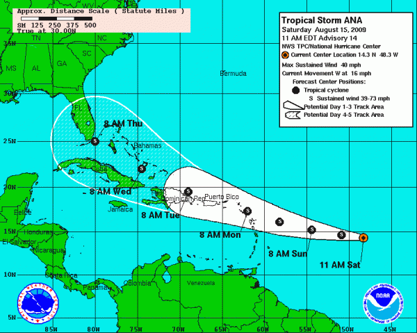
…Ana (pronounced AH-NA) is undergoing some wind shear this morning. It is also encountering some dry air. The center is exposed. These factors indicate that Ana may have some difficulty strengthening. The maximum intensity forecast by the Hurricane Center calls for 70 mph, which is below some of the guidance. The intensity forecast, as usual, is problematic.
…The projected track carries Ana into the northern Leeward Islands late Sunday night into Monday morning.

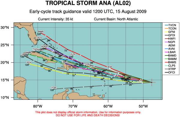
…The spread on the models is fairly large however.

…The morning run of the GFS does not recognize Ana very well and makes it an open wave moving to the west northwest.
…Tropical storm watches may be required for parts of the Leeward Islands by this afternoon.
TROPICAL DEPRESSION THREE
…
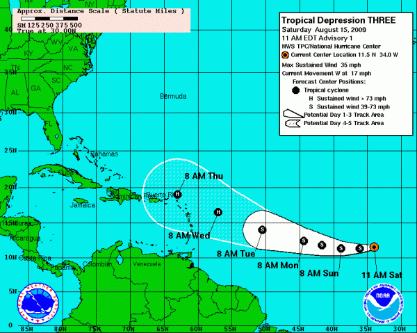
…The system should become a tropical storm by tonight.
…It is expected to become a hurricane by Wednesday morning. One of the most important models makes it a major hurricane.
…The morning run of the GFS does make it a major hurricane north of Hispaniola and moves it toward the Bahamas. It gets flaky by Friday, stalling the storm before it turns northward. It does present the idea that South Florida could be staring down the barrel of a laded hurricane on the 17th anniversary of Andrew (the 24th.)
…Unfortunately, everything out at five days and beyond is just an educated guess.
Category: Uncategorized


