Flash Flood Warning for Parts of Colbert and Lauderdale Counties Until 3:30 pm
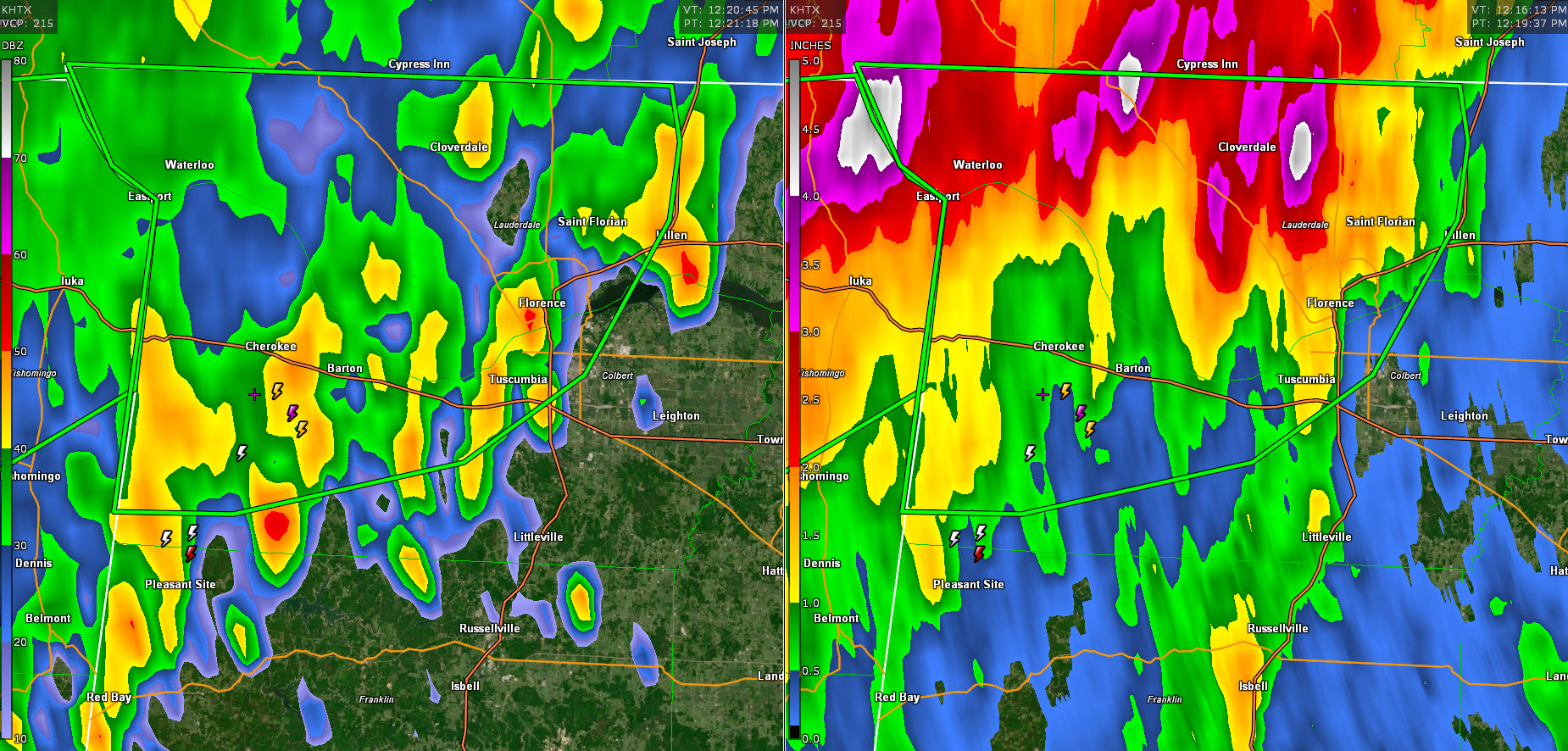
Heavy rain and storms continue across northeastern Mississippi, northwestern Alabama, and Middle Tennessee early this afternoon in the vicinity of a surface trough and frontal system. The activity is trying to drop southeast but should weaken with time as it runs into high pressure and drier air.
Many spots have already picked up 3-4 inches of rain and flash flooding is ongoing or imminent.
Turn around, don’t drown!!
THE NATIONAL WEATHER SERVICE IN HUNTSVILLE HAS ISSUED A
* FLASH FLOOD WARNING FOR…
NORTHWESTERN COLBERT COUNTY IN NORTHWESTERN ALABAMA…
LAUDERDALE COUNTY IN NORTHWESTERN ALABAMA…
* UNTIL 330 PM CDT.
* AT 1218 PM CDT, EMERGENCY MANAGEMENT REPORTED THUNDERSTORMS
PRODUCING HEAVY RAIN ACROSS THE WARNED AREA. BETWEEN 1 AND 4
INCHES OF RAIN HAVE FALLEN. FLASH FLOODING IS ONGOING OR EXPECTED
TO BEGIN SHORTLY.
HAZARD…FLASH FLOODING CAUSED BY THUNDERSTORMS.
SOURCE…EMERGENCY MANAGEMENT.
IMPACT…FLOODING OF SMALL CREEKS AND STREAMS, URBAN AREAS,
HIGHWAYS, STREETS AND UNDERPASSES AS WELL AS OTHER
DRAINAGE AND LOW LYING AREAS.
* SOME LOCATIONS THAT WILL EXPERIENCE FLASH FLOODING INCLUDE…
FLORENCE, MUSCLE SHOALS, SHEFFIELD, TUSCUMBIA, CHEROKEE, ST.
FLORIAN, UNDERWOOD-PETERSVILLE, WATERLOO, OAKLAND, BARTON, PRIDE
LANDING, THREET, RED ROCK, WRIGHT, POSEY LOOP, MT HESTER,
MARGERUM, RIVERTON, ZIP CITY AND MALONE.
Category: Alabama's Weather, ALL POSTS, Severe Weather
About the Author (Author Profile)
Bill Murray is the President of The Weather Factory. He is the site's official weather historian and a weekend forecaster. He also anchors the site's severe weather coverage. Bill Murray is the proud holder of National Weather Association Digital Seal #0001 @wxhistorianSubscribe
If you enjoyed this article, subscribe to receive more just like it.


