Late Night Notes on Sally
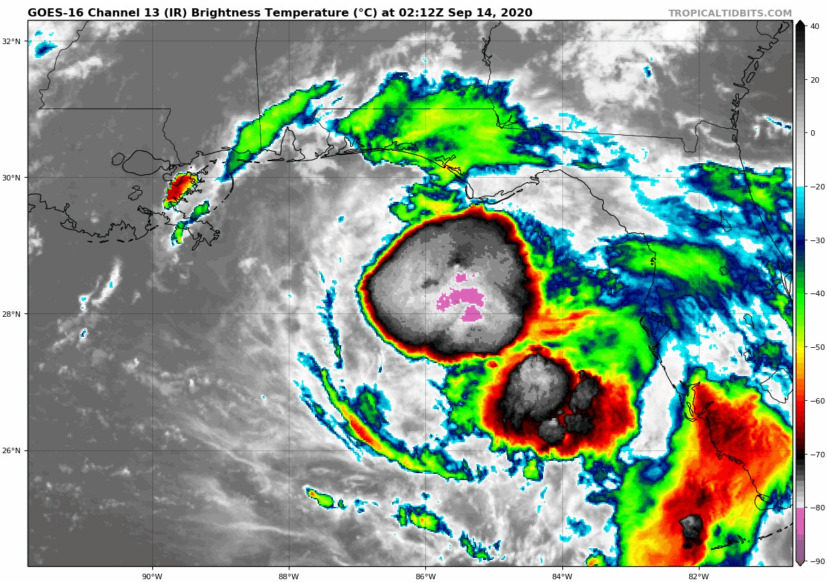
There has been a tremendous increase in convection in Tropical Storm Sally this evening. If it looked unhappy earlier, it looks downright mean now.
Outflow appears to be improving in all quadrants, and the central dense overcast is taking on a serrated look that signals goodo ventilation.
The central pressure has not fallen yet, but I think it will overnight.
The Air Force plane in the storm found 49-knot surface readings, which support the 60 mph intensity fully.
In addition, the storm is now forecast to slow down and take more of a right turn before landfall. The official forecast carries it to near Bay St. Louis MS again, arriving on the coast Tuesday afternoon. This will give it more time to intensify, which is worrisome. And the forecast track is west of most of the model consensus, so the Hurricane Center warns that the official track may be shifted eastward by morning.
A stronger storm would be more likely to turn to the right earlier, perhaps putting Mobile or the western Florida PPanhandle in play for landfall.
Hurricane warnings and the storm surge warning have been extended eastward to include the Alabama coast.
Sally is expected to make a fairly sharp northeastward turn after landfall, carrying it across Central Alabam on Thursday. Heavy rain, gusty winds, and brief tornaodes will be possible.
Rainfall will be a huge problem, with rains of 8-16 inches with isolated 24-inch amounts along the Gulf Coast from southeastern Louisiana to the western Florida Panhandle.
Category: Alabama's Weather, ALL POSTS, Tropical
About the Author (Author Profile)
Bill Murray is the President of The Weather Factory. He is the site's official weather historian and a weekend forecaster. He also anchors the site's severe weather coverage. Bill Murray is the proud holder of National Weather Association Digital Seal #0001 @wxhistorianSubscribe
If you enjoyed this article, subscribe to receive more just like it.


