An Update on the Central Alabama Weather Situation at 10:15 a.m.
It is a cloudy, mild, breezy morning in Birmingham and across Central Alabama as Hurricane Sally plods north-northeastward. Mid-level clouds are racing southwestward in the sky. Winds are averaging 10-15 with gusts to over 20 mph across North Central Alabama at places like Birmingham, with gusts to 30-35 mph at Montgomery and Ozark.
Aras generally along and south of a line from Geiger to Centreville to Lafayette will experience sustained 15-30 mph with gusts up to 45 mph through tonight. It will be breezy elsewhere
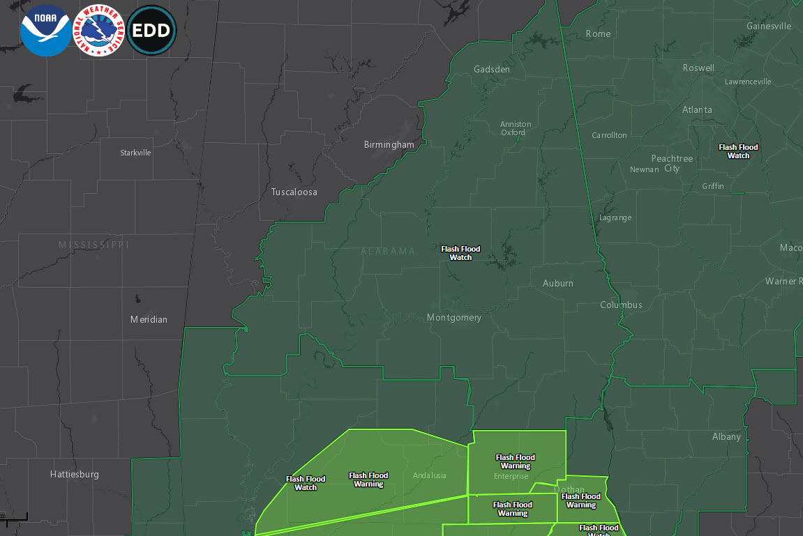
Rain is moving slowly northward and has reached Selma, and Wetumpka.
Moderate to heavy rain now covers areas along and east of I-65 south of Montgomery.
Feeder bands are working up into South Alabama now. These bands may produce 2.5 inches of rain per hour. The core is edging toward Brewton and Atmore in South Alabama as well. 5-6 inches of rain may fall in 6 hours from this heavy rainfall.
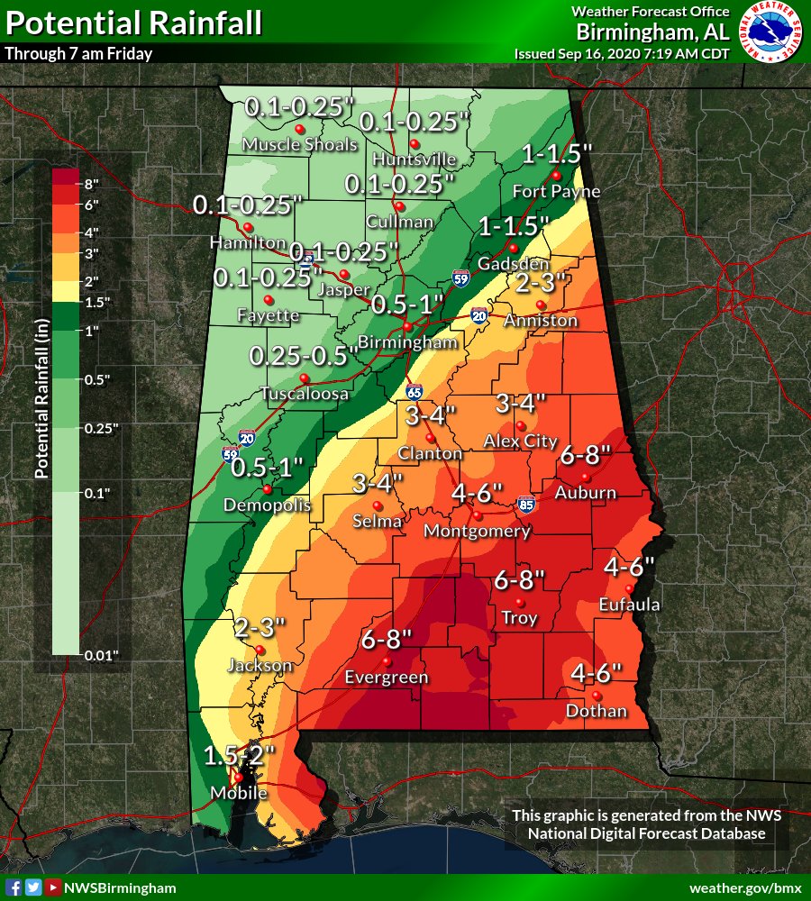
The highest totals will occur generally along and southeast of a line from Selma to Anniston through Thursday morning. Rainfall totals of 4″-8″ with locally higher amounts are expected. Significant flash flooding is possible and a Flash Flood Watch in effect.
Here is the expected rainfall map:
.
River flooding risk is primarily along the Alabama and Tallapoosa River Basins and their tributaries.
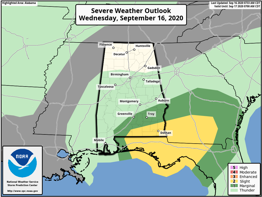
In addition, the tornado threat will be ramping up as those strong feeder bands start to ingest more instability. A few brief tornadoes will be possible south of I-85 this afternoon and evening. A tornado watch is in effect for South Alabama for places like Atmoree, Evergreen, Brewton, Andalusia, Enterprise, and Dothan.
Category: Alabama's Weather, ALL POSTS
About the Author (Author Profile)
Bill Murray is the President of The Weather Factory. He is the site's official weather historian and a weekend forecaster. He also anchors the site's severe weather coverage. Bill Murray is the proud holder of National Weather Association Digital Seal #0001 @wxhistorianSubscribe
If you enjoyed this article, subscribe to receive more just like it.


