Beta is Now a Tropical Depression; Heavy Rains Continue Over Portions of Texas
BULLETIN
Tropical Depression Beta Advisory Number 20
NWS National Hurricane Center Miami FL AL222020
1000 AM CDT Tue Sep 22 2020
…BETA WEAKENS TO A TROPICAL DEPRESSION OVER TEXAS…
…HEAVY RAINS EXPECTED TO CONTINUE OVER PORTIONS OF THE MIDDLE AND UPPER TEXAS COAST…
SUMMARY OF 1000 AM CDT…1500 UTC…INFORMATION
———————————————–
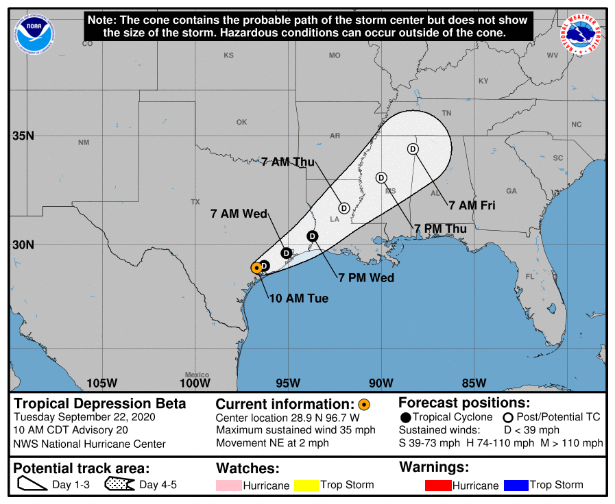
LOCATION…28.9N 96.7W
ABOUT 15 MI…25 KM ENE OF VICTORIA TEXAS
ABOUT 30 MI…45 KM WNW OF PALACIOS TEXAS
MAXIMUM SUSTAINED WINDS…35 MPH…55 KM/H
PRESENT MOVEMENT…NE OR 45 DEGREES AT 2 MPH…4 KM/H
MINIMUM CENTRAL PRESSURE…1005 MB…29.68 INCHES
WATCHES AND WARNINGS
——————–
There are no coastal watches or warnings in effect.
DISCUSSION AND OUTLOOK
———————-
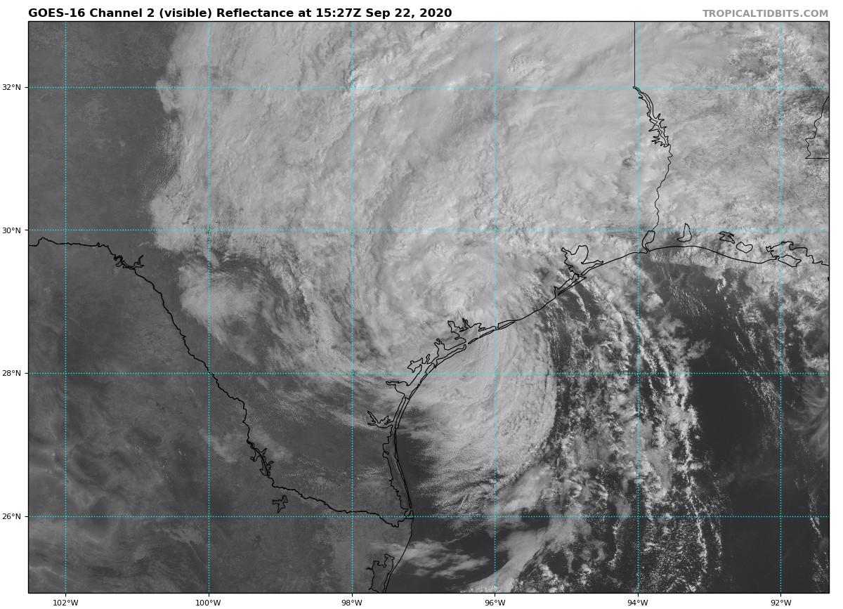
At 1000 AM CDT (1500 UTC), the center of Tropical Storm Beta was located by surface observations, satellites, and NOAA Doppler weather radars near latitude 28.9 North, longitude 96.7 West. The depression is drifting toward the northeast near 2 mph (4 km/h). A slow motion toward the east-northeast is expected by this afternoon and tonight. An east-northeastward to northeastward motion with increasing forward speed is expected Wednesday through Friday. On the forecast track, the center of Beta will move inland over southeastern Texas through Wednesday and then over Louisiana and Mississippi Wednesday night through Friday.
Data from surface observations and NOAA Doppler weather radars indicate that maximum sustained winds have decreased to near 35 mph (55 km/h) with higher gusts. Little change in strength is expected today with gradual weakening anticipated through Friday.
The estimated minimum central pressure based on nearby surface observations is 1005 MB (29.68 inches).
HAZARDS AFFECTING LAND
———————-
RAINFALL: For the middle and upper Texas coast, additional rainfall of 5 to 10 inches with isolated storm totals up to 20 inches is expected. Significant flash and urban flooding is occurring and will continue today. Minor to isolated moderate river flooding is likely.
Rainfall totals of 2 to 5 inches are expected east into the Lower Mississippi Valley through the end of the week. Flash and urban flooding is possible, as well as isolated minor river flooding on smaller rivers.
TORNADOES: A tornado or two could occur through Tuesday near the middle to upper Texas coast or the southwestern Louisiana coast.
SURF: Swells generated by a combination of Beta and a cold front over the northern Gulf of Mexico will continue along the coasts of Louisiana and Texas during the next couple of days. These swells are likely to cause life-threatening surf and rip current conditions.
Category: ALL POSTS, Severe Weather, Tropical
About the Author (Author Profile)
Scott Martin is an operational meteorologist, professional graphic artist, musician, husband, and father. Not only is Scott a member of the National Weather Association, but he is also the Central Alabama Chapter of the NWA president. Scott is also the co-founder of Racecast Weather, which provides forecasts for many racing series across the USA. He also supplies forecasts for the BassMaster Elite Series events including the BassMaster Classic.Subscribe
If you enjoyed this article, subscribe to receive more just like it.


