Some Showers Moving In From the Northwest at Midday; Marginal Risk for Severe Storms on Thursday
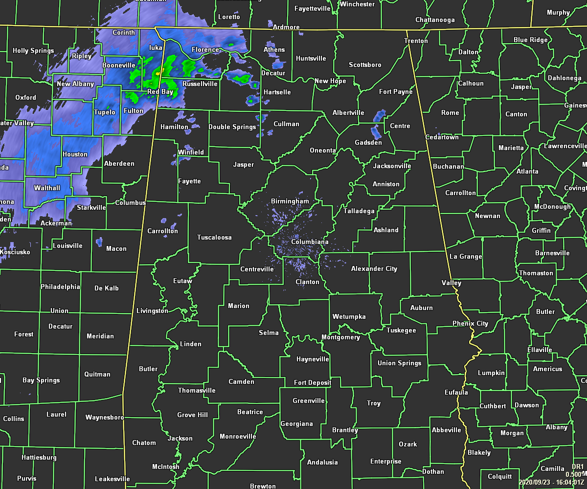
At 11:00 am, nearly all of Central Alabama is dry with the exceptions of showers moving into the northwestern parts of the area, and just a few isolated showers dotting the radar in Pickens and Etowah counties. Temperatures were in the 70s across the area. Troy was the warm spot at 79 degrees while Cullman was the cool spot and the only location in the 60s at 69 degrees. Birmingham was at 75 degrees.
We’ll continue to have a few scattered showers over the western parts of Central Alabama through the afternoon and into the early evening, with rain chances increasing across Central Alabama later this evening and through the overnight hours. No severe weather is expected for today as the main dynamics associated with Beta will continue to be located well off to our southwest throughout the day over eastern parts of Louisiana and southwestern parts of Mississippi. While a clap of thunder or two may be possible later this afternoon and into the evening, the potential for lightning is very low. Highs will be in the 70s across the area.
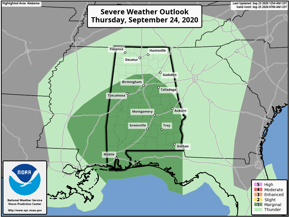
Thursday will be a cloudy and mainly wet day as showers and a couple of embedded thunderstorms will be likely throughout the day as the remnants of Beta continues to move through Central Alabama. When we get into the main heating of the day, there will be a Marginal Risk (level 1) for severe storms mainly south of a line from Millport (Lamar Co.) to Willburn (Cullman Co.) to Ashville (St. Clair Co.) to Five Points (Chambers Co.). A brief spin-up tornado and isolated damaging winds up to 60 MPH will be possible starting as early as 1:00 pm and potentially lasting as late as 10:00 pm.
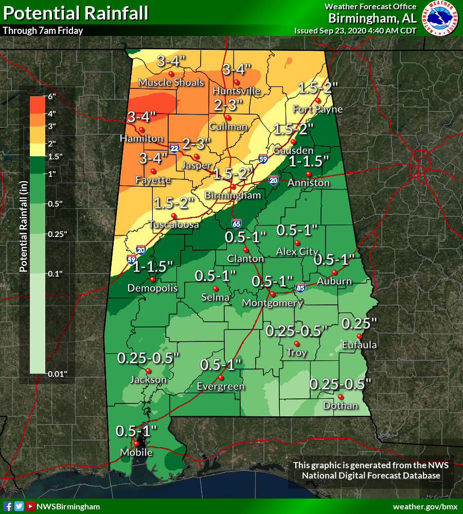
There is the potential for a few flash flooding issues in the north and northwestern parts of the area (mainly along and north of the I-59 corridor) where the heavier rainfall totals are expected to occur. Rainfall totals of 1.50-4.00 inches are possible north of the interstate, while totals will be much less south of the interstate ranging from 0.25-1.50 inches. Afternoon highs will reach the upper 60s to the upper 70s across the area.
Category: Alabama's Weather, ALL POSTS, Severe Weather
About the Author (Author Profile)
Scott Martin is an operational meteorologist, professional graphic artist, musician, husband, and father. Not only is Scott a member of the National Weather Association, but he is also the Central Alabama Chapter of the NWA president. Scott is also the co-founder of Racecast Weather, which provides forecasts for many racing series across the USA. He also supplies forecasts for the BassMaster Elite Series events including the BassMaster Classic.Subscribe
If you enjoyed this article, subscribe to receive more just like it.


