A Few Showers At Midday, Strong Storms Possible This Afternoon & Evening
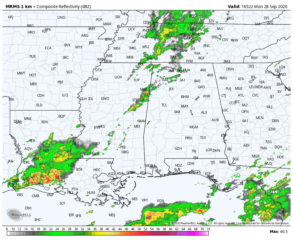
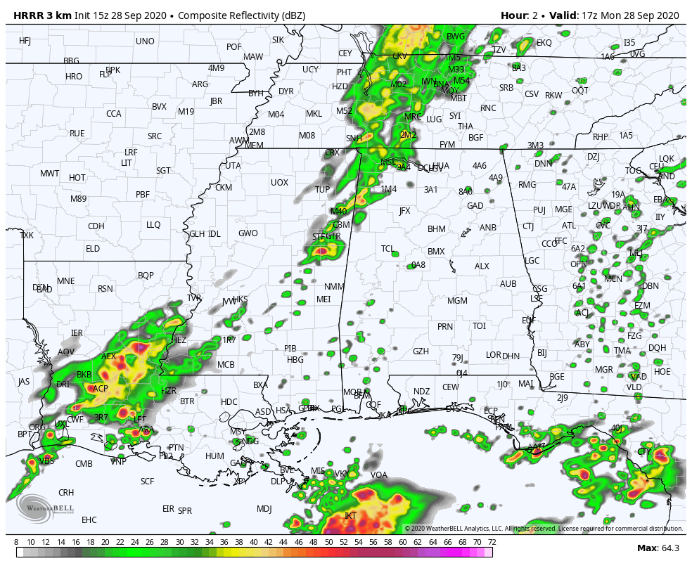
Radar check at 11:52 am shows that we have some shower activity over the northwestern parts of North/Central Alabama with storms starting to move into the western portions of Lamar and Pickens counties. Nothing strong at the moment, but a few strong and potentially a severe storm or two may be possible during the afternoon and into the evening hours.
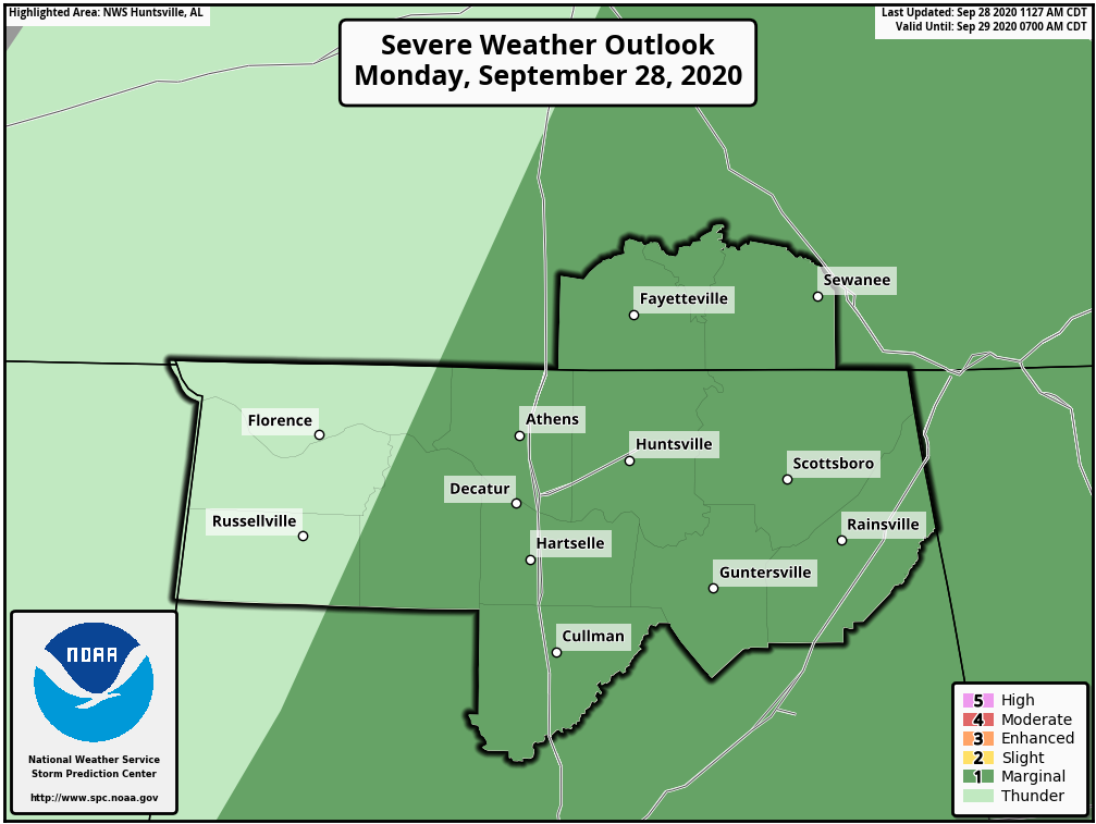
All of the eastern three-quarters of North Alabama remain in a Marginal Risk through the rest of the day. Nearly all of Colbert, Franklin, and Lauderdale counties are not included in the risk.
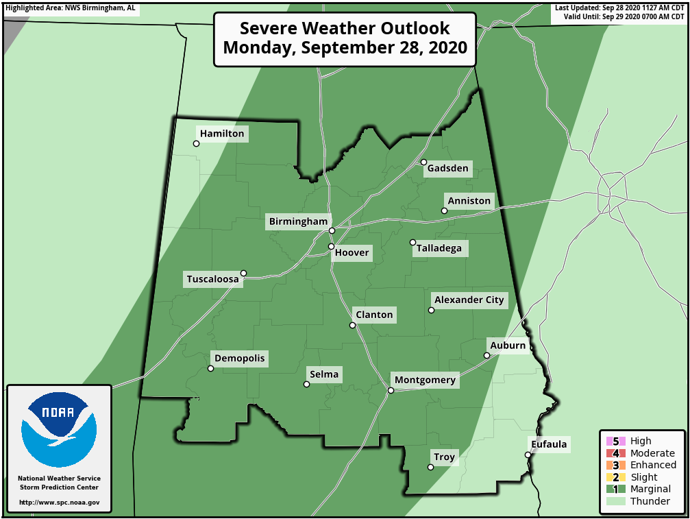
Nearly all of Central Alabama also remains in a Marginal Risk for severe storms through the rest of the day. Much of Lamar and Marion counties in the northwestern parts of Central Alabama are not included in the risk area, along with all of Barbour and Russell counties and portions of Pike, Bullock, Lee, and Chambers counties.
The threat of damaging winds up to 60 MPH will be possible from roughly now through 9:00 pm tonight from northwest to southeast. Tornadoes and hail are not expected.
After the storms and cold front moves through by later this evening and tonight, a few scattered showers may redevelop behind the front and move northeastward from the southwestern parts of the area. Some of those showers may linger for a little while into the late morning hours on Tuesday.
Category: Alabama's Weather, ALL POSTS, Severe Weather
About the Author (Author Profile)
Scott Martin is an operational meteorologist, professional graphic artist, musician, husband, and father. Not only is Scott a member of the National Weather Association, but he is also the Central Alabama Chapter of the NWA president. Scott is also the co-founder of Racecast Weather, which provides forecasts for many racing series across the USA. He also supplies forecasts for the BassMaster Elite Series events including the BassMaster Classic.Subscribe
If you enjoyed this article, subscribe to receive more just like it.


