Bill and Ana

Most of our attention this afternoon is trained on Tropical Storm Claudette, which is making its move toward the Central Gulf Coast. But we have two other named storms in progress in the Atlantic. Here is the latest.
ANA DOWNGRADED TO A TROPICAL DEPRESSION
Air Force reconnaissance could barely find a closed circulation in Ana this afternoon. If there is no well defined center before the plane exits the area this evening, advisories may be discontinued. The depression or remnants will pass into the eastern Caribbean tonight to near Hispaniola late Monday night. It will cross Haiti (the last thing they need) and skirt along the southern coast of Cuba. If it holds together and gets into the Gulf of Mexico, that would occur on Thursday and there is a chance there could be regeneration then. It is something we will watch for the end of the week into the weekend.
TROPICAL STORM BILL
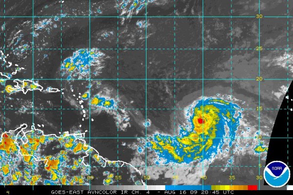
Bill has top winds of 65 mph. It is 1,300 miles east of the Windward Islands, moving WNW at 16 mph. It is expected to recurve to the north of the islands on Wednesday and Thursday. It should become a hurricane later tonight and a major hurricane late Tuesday or on Wednesday. It does not look like Bill will affect the United States, thanks to a developing trough along the East Coast.
SCROLL UP FOR THE LATEST ON CLAUDETTE
SCROLL DOWN FOR INTERESTING HISTORICAL INFO ON 1969’S HURRICANE CAMILLE.
Category: Uncategorized


