Portions of Central Alabama Have Been Upgraded to a Slight Risk on Saturday
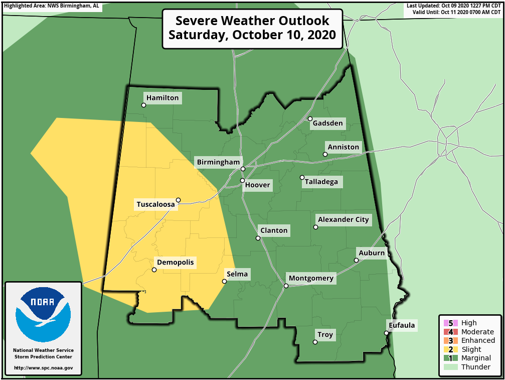
The Storm Prediction Center has upgraded the west and southwestern parts of Central Alabama to a level 2 Slight Risk for severe storms on Saturday. Nearly all of the rest of the area remains in a level 1 Marginal Risk. Here is the latest Day 2 Convective Outlook from the SPC:
SUMMARY: A few tornadoes are possible on Saturday across parts of Alabama and Mississippi. Severe gusts are possible across parts of northern New York into western Maine.
MS/AL/FL Panhandle: Tropical cyclone Delta will move from northeast Louisiana to near the AL/MS/TN border during the period according to the latest National Hurricane Center forecast. A very moist airmass will become conditionally unstable during the day amidst thinning cloud cover/cloud breaks within the southeast quadrant of Delta. Modest heating will contribute to weak buoyancy (250-750 J/kg MLCAPE) maximizing in an arc from southwest AL northward near the AL/MS border and protruding north-northwestward into north-central MS by mid-late afternoon. It appears a window of opportunity for appreciable destabilization will overlap with strong low-level flow/enlarged hodographs to yield a risk for a more focused zone of low-level mesoyclone potential. It seems the tornado threat will be highest during the afternoon and perhaps linger into the early evening before diminishing coincident with the loss of diurnal heating.
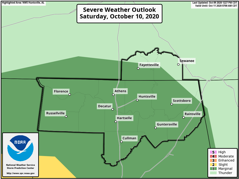
No change in thinking for North Alabama at this point as nearly the enite area remains in a level 1 Marginal Risk for severe storms on Saturday.
Category: Alabama's Weather, ALL POSTS, Severe Weather, Tropical
About the Author (Author Profile)
Scott Martin is an operational meteorologist, professional graphic artist, musician, husband, and father. Not only is Scott a member of the National Weather Association, but he is also the Central Alabama Chapter of the NWA president. Scott is also the co-founder of Racecast Weather, which provides forecasts for many racing series across the USA. He also supplies forecasts for the BassMaster Elite Series events including the BassMaster Classic.Subscribe
If you enjoyed this article, subscribe to receive more just like it.


