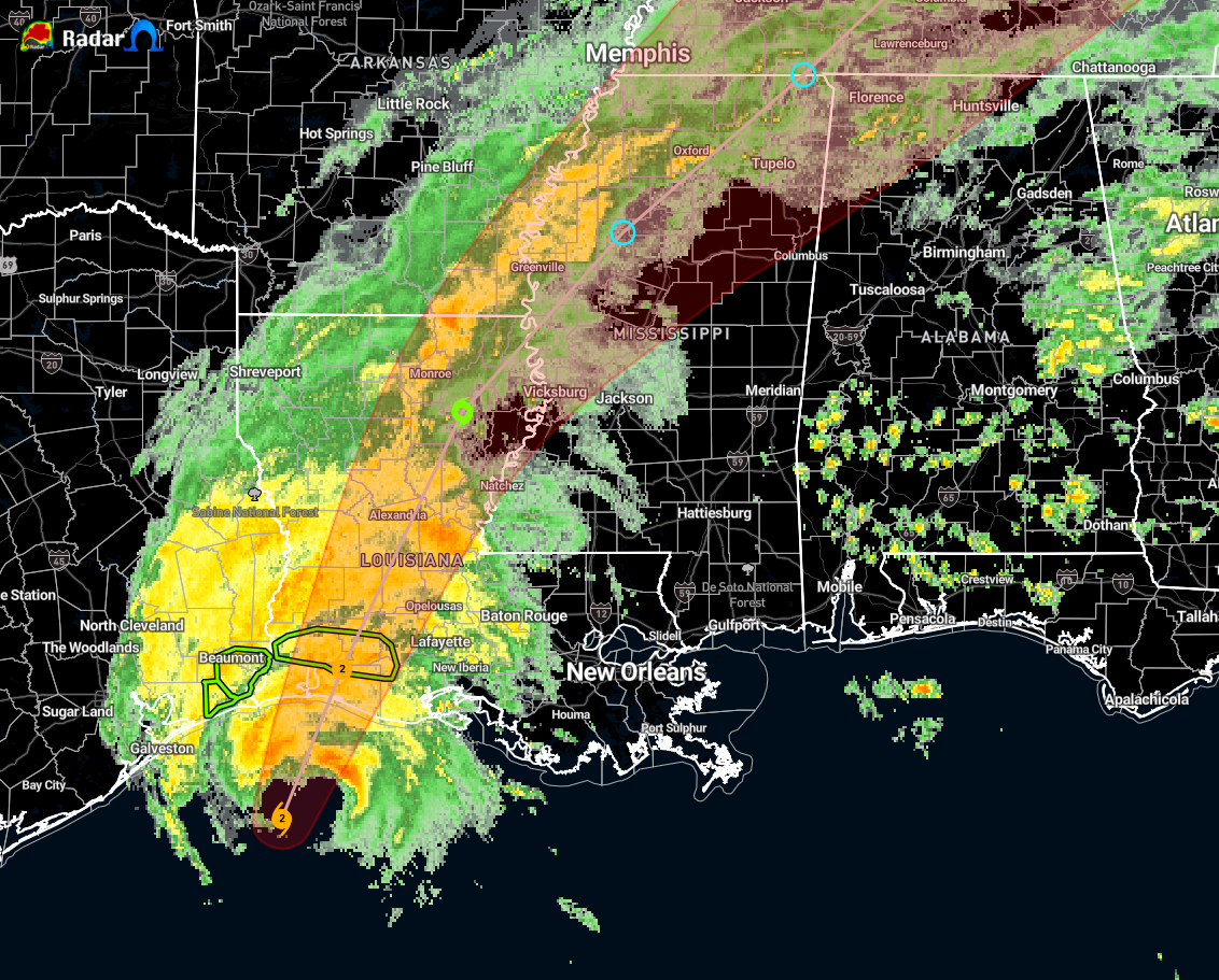
Water Levels Increasing Along the Coast of Louisiana
…2 PM CDT POSITION UPDATE…
…WATER LEVELS INCREASING ALONG THE COAST OF LOUISIANA AS THE CENTER OF DELTA MOVES CLOSER…
SUMMARY OF 200 PM CDT…1900 UTC…INFORMATION
LOCATION…28.9N 93.5W…ABOUT 65 MI…105 KM S OF CAMERON LOUISIANA
MAXIMUM SUSTAINED WINDS…105 MPH…165 KM/H
PRESENT MOVEMENT…NNE OR 15 DEGREES AT 14 MPH…22 KM/H
MINIMUM CENTRAL PRESSURE…966 MB…28.53 INCHES
A NOAA National Ocean Service water level gauge at Freshwater Canal Locks, Louisiana, recently reported storm surge inundation of a little over 4 feet above ground level.
The Texas Coastal Ocean Observation Network station at Texas Point recently reported sustained winds of 53 mph (85 km/h) and a wind gust of 64 mph (103 km/h).
A wind gust to 51 mph (81 km/h) has been reported at the Jack Brooks Regional Airport near Port Arthur, Texas, within the past hour.
A WeatherFlow observing site near Cameron, Louisiana, recently reported a wind gust to 44 mph (71 km/h).
Category: ALL POSTS, Severe Weather, Tropical
About the Author (Author Profile)
Scott Martin is an operational meteorologist, professional graphic artist, musician, husband, and father. Not only is Scott a member of the National Weather Association, but he is also the Central Alabama Chapter of the NWA president. Scott is also the co-founder of Racecast Weather, which provides forecasts for many racing series across the USA. He also supplies forecasts for the BassMaster Elite Series events including the BassMaster Classic.Subscribe
If you enjoyed this article, subscribe to receive more just like it.


