Risk for Tornadoes for the Southern Portions of Alabama and Into the Florida Panhandle
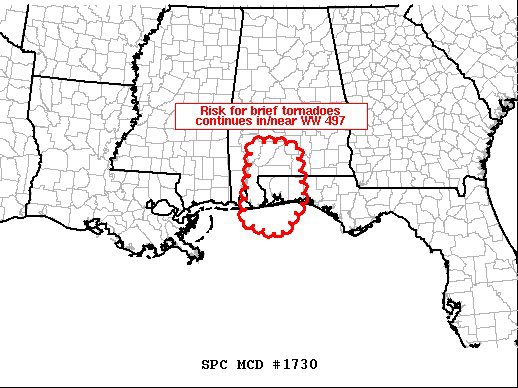
MESOSCALE DISCUSSION #1730
SUMMARY…Risk for brief tornadoes continues across Tornado Watch 497, in conjunction with Tropical Storm Delta.
DISCUSSION…Latest radar loop shows the center of Tropical Storm Delta near the intersection of the Arkansas/Louisiana/Mississippi borders. A primary band of convection east/southeast of Delta’s center continues advancing eastward across southwestern Alabama, while individual convective elements move quickly northward.
Within this band of low-topped convection, occasional cells have exhibited low-level rotation, with at least one confirmed tornado earlier this morning. While a moist boundary layer resides ahead of the convective band, CAPE remains limited, particularly with northward extent into central Alabama. Still, low-level flow veering/increasing with height is yielding shear quite favorable for occasional low-level rotation within sustained updrafts. As such, the risk for brief tornadoes will continue across the watch area.
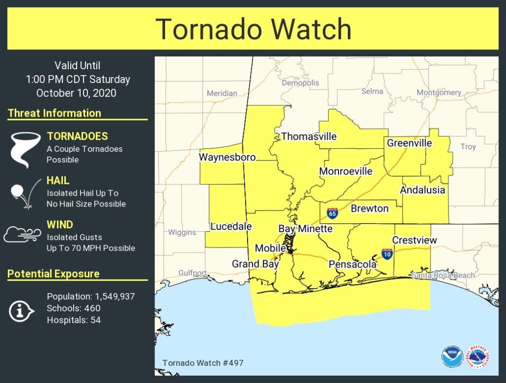
A Tornado Watch has been issued for Baldwin, Butler, Clarke, Conecuh, Covington, Crenshaw, Escambia, Monroe, and Wilcox counties in Southwest Alabama until 1:00 pm today.
Category: Alabama's Weather, ALL POSTS, Severe Weather, Tropical
About the Author (Author Profile)
Scott Martin is an operational meteorologist, professional graphic artist, musician, husband, and father. Not only is Scott a member of the National Weather Association, but he is also the Central Alabama Chapter of the NWA president. Scott is also the co-founder of Racecast Weather, which provides forecasts for many racing series across the USA. He also supplies forecasts for the BassMaster Elite Series events including the BassMaster Classic.Subscribe
If you enjoyed this article, subscribe to receive more just like it.


