

Strong Storms Over Northwest Alabama
Scattered showers cover areas northwest of I-59 early this afternoon, with some stronger storms in the northwestern corner of the state.
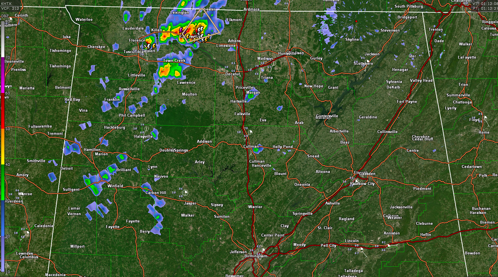
One storm is along US-72 between Killen and Rogersville in eastern Lauderdale County. It is moving into northwestern Limestone County.
Another has formed southeast of Florence in Colbert County. It will move into southeastern Lauderdale County.
Both storms are capable of small hail and 40 mph wind gusts. There is a chance they could become briefly severe.
Showers and storms will continue to slowly increase in coverage into the overnight hours, but generally in areas northwest of I-59.
The rest of Central Alabama is dry, mostly sunny, and warm this afternoon:

Additional showers and storms will form this evening over Central Alabama, but the good news is that most of the I-59 Corridor and points south could be dry through midnight with the exception of a few showers or storms that form.
Rain and storms will increase after midnight across the rest of Central Alabama as a slow-moving front tries to push into the area overnight. Those showers and storms will move out fairly quickly Saturday morning, allowing for some clearing late in the day.
We are watching a tropical disturbance in the western Caribbean that could become a tropical depression in the next 24 hours. It will eventually become Tropical Storm Zeta and could impact the Gulf Coast next week. We will have frequent updates on this developing situation.
Category: Alabama's Weather, ALL POSTS
About the Author (Author Profile)
Bill Murray is the President of The Weather Factory. He is the site's official weather historian and a weekend forecaster. He also anchors the site's severe weather coverage. Bill Murray is the proud holder of National Weather Association Digital Seal #0001 @wxhistorianSubscribe
If you enjoyed this article, subscribe to receive more just like it.


